
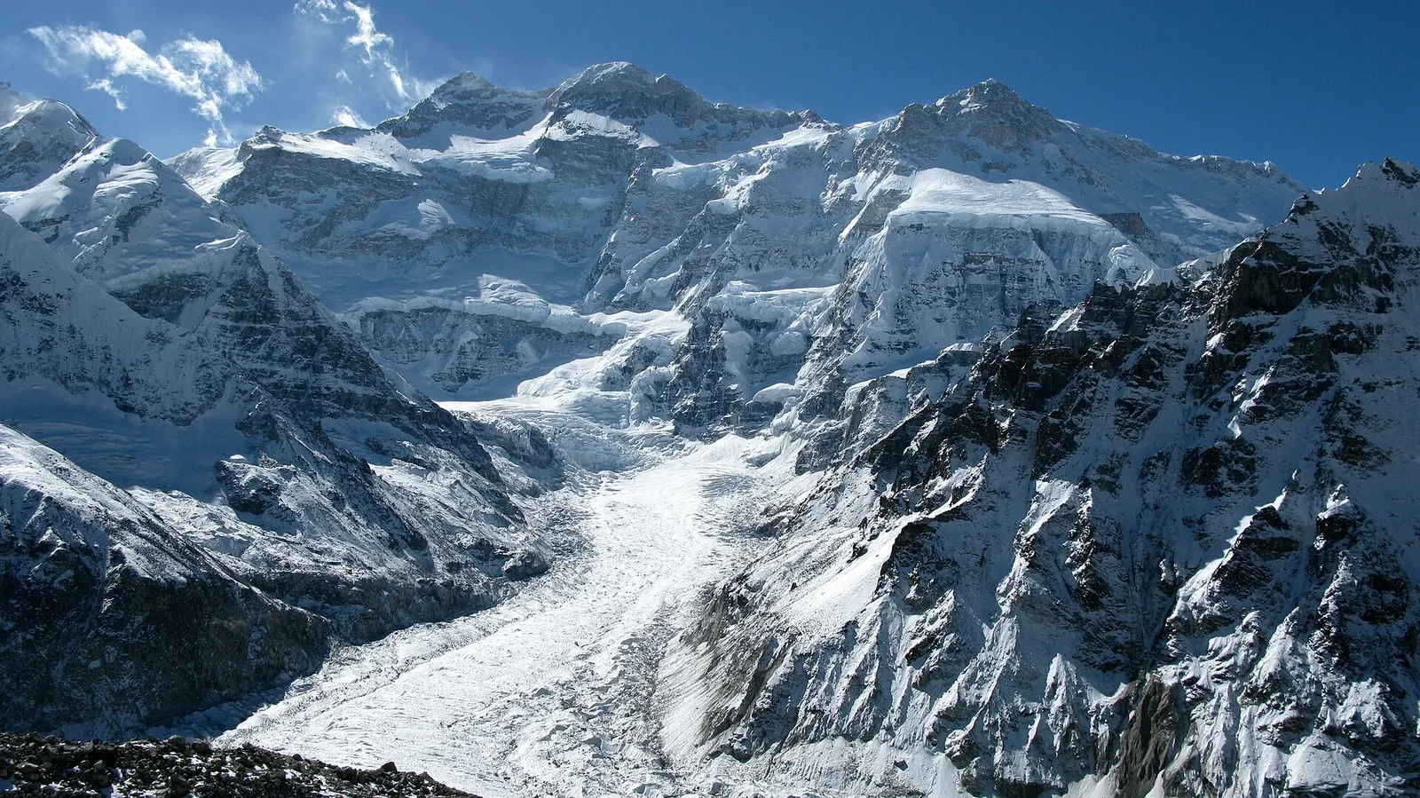
A three-week restricted-area trek in far eastern Nepal that reaches both Kanchenjunga base camps, Pangpema in the north and Oktang in the south, joined by the Sele La pass crossing.
- Days
- 20 days
- Maximum altitude
- 5,143 m
- Difficulty
- Challenging
A network of high and mid-hill routes about 1,700 km long that crosses Nepal from Kanchenjunga in the east to Humla and the far west, usually walked in sections, or as a through-trek of about four to five months.
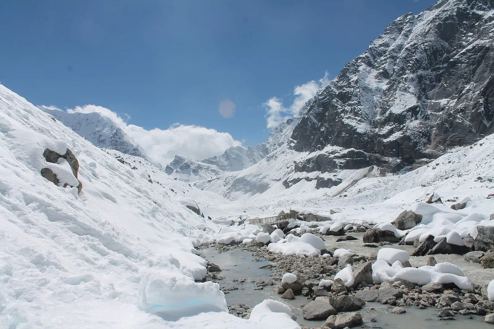
The Great Himalaya Trail is the name given to a chain of trekking routes that together cross the length of Nepal, from the Kanchenjunga region on the Sikkim border to Humla and Darchula in the far west. In Nepal it is made up of two broad lines: a High Route that keeps close to the main Himalayan range and crosses passes of more than 6,000 m, and a lower Cultural Route through the middle hills, with villages, farmland and lodges.
The route was first walked and documented as a continuous line in 2008 and 2009 by a team led by Robin Boustead, which took 162 days, and the government of Nepal and partner organisations have promoted it since 2011 as a way to bring tourism income to remote mountain districts. Very few people walk it end to end; most trekkers complete one or two sections at a time, often over several years.
This page is an overview. Each stage below summarises one of the ten sections commonly used in Nepal, with a representative point and high point, and links to the Firfirey trek and place pages that cover parts of it in detail.
Why it is rated challenging
The High Route links the upper valleys of each mountain region and crosses glaciated passes such as Sherpani Col and West Col between Makalu and Everest, and the Tashi Lapcha between Everest and Rolwaling. These sections need mountaineering skills, fixed ropes in places, and a full camping crew. Sherpani Col, at about 6,160 m, is usually given as the highest point.
The Cultural Route, sometimes called the lower route, runs through the middle hills at roughly 1,000 to 3,500 m, linking district towns, farming villages and pilgrimage sites. It has more lodges and homestays, more road crossings and fewer high passes, and it is walkable for much of the year outside the monsoon. Many through-walkers mix the two, taking the high line where conditions and permits allow and dropping to the lower line elsewhere.
A through-walk of the Nepal High Route usually takes about 120 to 160 days including rest and weather days. Published section times add up to more than this, because each section estimate includes the walk in from a road head or airstrip, which a through-walker does not repeat. Fast parties with strong support have finished in far less time, but that is unusual.
Because the passes at each end of the range are only safely crossable in certain seasons, through-walkers usually walk the eastern sections in spring and the western sections in late spring and the monsoon rain shadow, or split the walk over two seasons, as the first documented walk did.
Almost every section crosses at least one national park or conservation area, and many enter restricted areas that require permits issued only through registered agencies for groups with a licensed guide. These include Taplejung (Kanchenjunga), Sankhuwasabha (Makalu side), Solukhumbu north of Thame, Dolakha (Rolwaling), Manaslu, Tsum, Nar Phu, Upper Mustang, Upper and Lower Dolpo, Mugu, Humla, Bajhang and Darchula. The Department of Immigration publishes the restricted-area list and fees.
Food and fuel are scarce in the remotest stretches, especially between Makalu and Everest, in Upper Dolpo and in the far west, so supplies are carried by porters or flown to airstrips such as Lukla, Jomsom, Juphal, Jumla, Talcha and Simikot. Budget for flights, permits and a crew for the camping sections.
Many of Nepal's established treks form part of the Great Himalaya Trail, so a single section can be as simple as an existing trek: the Kanchenjunga Circuit, the Manaslu Circuit, the Annapurna Circuit or Upper Mustang, for example. The harder links between them, such as Makalu to Everest over Sherpani Col, Everest to Rolwaling over the Tashi Lapcha, Mustang to Dolpo and Dolpo to Rara, are the sections that give the trail its reputation.
Choose a section by season, the time you have and your experience on snow and ice. Sections in the east are wetter and greener, and those west of the Annapurna range lie largely in the rain shadow, with drier, more Tibetan landscapes.
Representative altitude for each stage of the route. The dashed lines at 3,000 m and 4,000 m mark heights where altitude illness becomes more common. General information only, not medical advice.
Hover, tap or use the arrow keys to see each day. Shaded columns are acclimatisation days.
| Day | Overnight | Sleeping altitude | High point |
|---|---|---|---|
| 1 | Olangchung Gola | 3,200 m | 5,143 m |
| 2 | Chhukung (Khumbu) | 4,730 m | 6,160 m |
| 3 | Beding (Rolwaling) | 3,690 m | 5,755 m |
| 4 | Kyanjin Gompa (Langtang) | 3,870 m | 5,320 m |
| 5 | Larkya La (Manaslu) | 5,106 m | - |
| 6 | Lo Manthang (Upper Mustang) | 3,840 m | 5,416 m |
| 7 | Shey Phoksundo Lake | 3,612 m | 5,350 m |
| 8 | Rara Lake | 2,990 m | 5,115 m |
| 9 | Hilsa (Tibet border) | 3,650 m | 4,995 m |
| 10 | Darchula | 900 m | 3,900 m |
Up the Tamor and Ghunsa valleys to Pangpema below the north face of Kanchenjunga, then across the Nango La to Olangchung Gola, a Tibetan-heritage trading village near the Tibet border. Restricted area permit required.
Teahouses and campingAbout Olangchung Golahigh point Pangpema (Kanchenjunga North Base Camp), 5,143 m
Over the Lumba Sambha pass to the upper Arun valley and Thudam, then up the Barun valley to Makalu Base Camp. The High Route then crosses Sherpani Col, West Col and the Amphu Labtsa into the Everest region, a serious mountaineering crossing.
CampingAbout Chhukunghigh point Sherpani Col, 6,160 m
Through the Khumbu, often over one or more of the Three High Passes, to Thame, then over the glaciated Tashi Lapcha into the Rolwaling valley, past Tsho Rolpa lake and down to Beding. The Tashi Lapcha needs ropes and mountaineering experience.
Teahouses in Khumbu, camping in RolwalingAbout Bedinghigh point Tashi Lapcha, 5,755 m
West through the hills of Dolakha and Sindhupalchok and the Panch Pokhari area, then over the Tilman Pass into the upper Langtang valley at Kyanjin Gompa, before walking out to Syabrubesi. The Helambu and Gosaikunda trails offer a lower alternative.
Camping, then teahouses in LangtangAbout Kyanjin Gompahigh point Tilman Pass, 5,320 m
Across the Ganesh Himal foothills and the Ruby Valley to the Budhi Gandaki, with an optional detour into Tsum, then up the Manaslu Circuit to the Larkya La and down to Bimthang and the Marsyangdi valley. Manaslu and Tsum are restricted areas.
Teahouses and campingAbout Larkya La
Up the Annapurna Circuit to Manang and over the Thorong La to Muktinath, then north through Upper Mustang to Lo Manthang. The High Route instead goes through Nar Phu and over the Saribung pass, at about 6,000 m, into the Damodar Kunda area and Upper Mustang.
Teahouses, camping on the high variantsAbout Lo Manthanghigh point Thorong La, 5,416 m
West from Mustang across high, dry country to Chharka Bhot and into Upper Dolpo, past Shey Gompa and over the Kang La to Shey Phoksundo Lake. Upper Dolpo is a restricted area with high permit fees, and the route is camping only.
CampingAbout Shey Phoksundo Lakehigh point Kang La, 5,350 m
Over the Kagmara La to the Jumla valleys and on north to Rara Lake in Rara National Park. A longer high route links Dolpo directly to Mugu through restricted country further north.
Camping and homestaysAbout Rara Lakehigh point Kagmara La, 5,115 m
North through Mugu to Simikot, the headquarters of Humla, then through the Limi valley and its Tibetan-heritage villages and over the Nyalu La to Hilsa on the Karnali at the Tibet border, the traditional end of the High Route. Humla and Limi are restricted areas.
CampingAbout Hilsahigh point Nyalu La, 4,995 m
An optional final section through Bajhang and the Saipal area to Api Base Camp and down to Darchula on the Mahakali river at the India border. This is the least walked part of the trail, with few facilities and restricted areas in Bajhang and Darchula.
Camping and homestayshigh point Api Base Camp, 3,900 m
Stages, times and altitudes vary by operator, weather and pace. Partner agencies confirm the exact plan.
Approximate route drawn through the overnight stops.
Restricted area permits (several districts)Restricted area
Needed for sections in Taplejung, Sankhuwasabha, Solukhumbu (north of Thame), Dolakha, Gorkha (Manaslu and Tsum), Manang (Nar Phu), Upper Mustang, Dolpo, Mugu, Humla, Bajhang and Darchula. Issued by the Department of Immigration through registered agencies; fees differ widely by area.
National park entry permitsNational park
Makalu Barun, Sagarmatha, Langtang, Shey Phoksundo and Rara National Parks, among others; check the current fees with the Department of National Parks and Wildlife Conservation.
Conservation area entry permitsConservation area
Kanchenjunga, Gaurishankar, Manaslu and Annapurna Conservation Areas, among others.
Khumbu Pasang Lhamu Rural Municipality entry permitLocal
Required in the Everest region, collected at Lukla or Monjo.
TIMS cardTrekker card
Check whether a TIMS card is currently required for each section; it is issued through registered agencies.
Restricted area
Many sections pass through restricted areas. Restricted-area permits are issued only through a government-registered trekking agency, for trekkers accompanied by a licensed guide; the rules have long required a minimum group of two trekkers, and changes have been reported, so confirm the current rule with the Department of Immigration or a licensed agency.Verify before travel: permit rules and fees change. Checked 2026-10-06 against Department of Immigration, Nepal: trekking route and permit fee. Guide rule: Nepal bans solo trekking for tourists, guides mandatory from April 1 (The National, March 2023).
Nepal trekking permits explainedBest months: Mar-May, Sep-Nov
Nearest hub: Dolakha. Times are typical ranges, not schedules, and vary with roadworks, weather and the season.
By busfrom Kathmanduabout 5-7 hLocal buses
Buses run as far as Charikot and the Tamakoshi valley; onward travel to the roadheads is by jeep.
When to set off: Charikot buses leave Kathmandu in the morning.
Kalinchowk destination guide (Government of Nepal, film.gov.np)
By car or jeepfrom Kathmanduabout 8-10 h
By jeep via Charikot and north up the Tamakoshi towards the Singati, Gongar, Chhetchhet and Simigaun roadheads; how far vehicles get varies with the state of the road.
Road: Sealed to Charikot, then a rough, narrow and very slide-prone valley road up the Tamakoshi; a jeep is normally needed.
When to set off: Leave Kathmandu by 05:30 to 06:00: this is a very long jeep day and the valley road is slow.
By motorbikefrom DolakhaNot recommended
The Tamakoshi valley road is rough, exposed and slide-prone; not a sensible ride, and the trek itself is on foot.
Road: Rough, narrow and slide-prone valley road north of Charikot.
On footfrom DolakhaAbout 2-3 days from the roadhead to Beding, a day on to Na, then Tsho Rolpa as a long day trip
On foot from the roadhead up the Rolwaling gorge to Beding and Na, then a long day to Tsho Rolpa. The Tashi Lapcha pass at 5,755 m links the valley to the Khumbu and is a mountaineering crossing.
When to set off: Start each stage early; the gorge trail is long and the upper valley clouds over by afternoon.
Typical seasonal exposure along the route, merged from the stops that have a place page. Seasonal patterns only, never conditions today.
Altitudehigh in a typical yearAll year
The region runs from about 2,600 m at Phakding to about 5,360 m at Everest Base Camp, and most itineraries sleep above 4,000 m for several nights. Acute mountain sickness is common on fast ascents - it affects roughly 40 per cent of people who go up quickly to 3,000 m, and more above that. General information, not medical advice: gain height slowly, keep sleeping-height gains small (about 300 m a day once high), build in rest days, learn the symptoms - headache, nausea, breathlessness, broken sleep - and descend if they get worse. See a doctor before travelling and carry insurance that covers helicopter evacuation.
Recorded for Everest Region (Khumbu), Rolwaling Valley, Kyanjin Gompa, Larkya La and 3 more. Altitude sickness - Wikipedia
Snowhigh in a typical yearOct-May
Deep winter snow can block the trails above Tengboche, and spring storms leave fresh snow on the higher stages; December to March is the usual snow window at this height.
Recorded for Everest Region (Khumbu), Rolwaling Valley, Kyanjin Gompa, Larkya La and 4 more. Everest Base Camp Trek - Wikivoyage
Seasonal closurehigh in a typical yearJun-Sep, Dec-Feb
Lukla flights are the weak link in the monsoon: poor visibility stops operations at the airstrip about half the time in that season and about half of flights are cancelled, and waits of several days happen. Any itinerary built on the flight needs spare days at both ends.
Recorded for Everest Region (Khumbu), Larkya La. Tenzing-Hillary Airport - Wikipedia
Coldhigh in a typical yearNov-Mar
Nights are far below freezing from November to March at this height, with wind on the open moraine and unheated bedrooms in the teahouses; a winter-rated sleeping bag and down layer are the norm.
Recorded for Everest Region (Khumbu), Rolwaling Valley, Kyanjin Gompa, Larkya La and 4 more. Everest Base Camp Trek - Wikivoyage
Otherhigh in a typical yearAll year
Monsoon cloud over Pokhara and the gorge frequently delays or cancels the Jomsom flight; the airstrip is below the minimum for visual approaches roughly 15 per cent of the year, so spare days matter.
Recorded for Everest Region (Khumbu), Lo Manthang, Phoksundo Lake, Rara Lake and 1 more. Jomsom Airport, Wikipedia
Road blockageshigh in a typical yearJun-Sep
The mountain roads into Solukhumbu turn muddy and slippery in the monsoon and landslides are possible, so road journeys from Kathmandu run much slower in June to September.
Recorded for Everest Region (Khumbu), Rolwaling Valley, Lo Manthang, Limi Valley. Kathmandu to Dhap Village - Himalayan Masters
Landslideshigh in a typical yearJun-Sep
The Araniko Highway corridor runs under extremely steep hillsides that are very prone to landslides, and large slides after heavy rain are a recurring monsoon pattern on this route.
Recorded for Rolwaling Valley, Kyanjin Gompa, Larkya La, Lo Manthang and 3 more. Araniko Highway (Wikipedia)
River crossingsmoderate in a typical yearJun-Sep
The route crosses and recrosses the Dudh Koshi on suspension bridges between Lukla and Namche; the river runs high through the monsoon and the bridge approaches are slippery then.
Recorded for Everest Region (Khumbu), Phoksundo Lake. Everest Base Camp Trek - Wikivoyage
Floodingmoderate in a typical yearAll year
Glacial lake outburst floods are a real hazard in these valleys: Thame in the Bhote Koshi valley was inundated on 16 August 2024 and at least 15 structures were destroyed. Such floods are most likely in the warm, wet months.
Recorded for Everest Region (Khumbu), Rolwaling Valley. Thame, Nepal - Wikipedia
Avalanche terrainmoderate in a typical yearDec-Apr
The upper Langtang valley is geologically active and avalanche paths reach the valley floor; the 2015 earthquake-triggered avalanche that destroyed Langtang village is the extreme case, while snow-loaded slopes in winter and early spring are the ordinary seasonal concern.
Recorded for Kyanjin Gompa. Langtang Valley Trek (Wikivoyage)
Check current conditions before you travel
Nothing here describes the Great Himalaya Trail (Nepal) today. Trail, road, pass and flight conditions change with the weather and with roadworks. Check the Department of Hydrology and Meteorology, the Nepal Disaster Risk Reduction Portal and the local authority or your licensed operator before and during the trek.
Forecasts for start (Olangchung Gola, 3,200 m), highest overnight (Larkya La, 5,106 m), end (Darchula, 900 m). Mountain weather changes fast; check again on the day.
Forecast for 3,200 m. Conditions change fast in the mountains.
Weather data: MET Norway, licensed CC BY 4.0. A forecast, not a guarantee.
Forecast for 5,106 m. Conditions change fast in the mountains.
Weather data: MET Norway, licensed CC BY 4.0. A forecast, not a guarantee.
Forecast for 900 m. Conditions change fast in the mountains.
Weather data: MET Norway, licensed CC BY 4.0. A forecast, not a guarantee.
The eastern section in detail, with both base camps and the Sele La crossing.
The Khumbu passes used by many through-walkers on the Everest section.
The upper Langtang valley, reached over the Tilman Pass on the High Route.
The core of the Manaslu and Ganesh section, over the Larkya La.
The walled town of Lo Manthang and the high desert of Lo, on the Annapurna and Mustang section.
Shey Gompa, the Kang La and Shey Phoksundo Lake on the Dolpo section.
The Rara and Jumla section, Nepal's largest lake in Karnali.
The Humla section through Tibetan-heritage villages to Hilsa.
A plateau park in the far west, reachable from the Cultural Route through Bajhang and Doti.
About 1,700 km for the Nepal network, with the exact distance depending on the mix of High and Cultural Route sections. A full traverse usually takes about 120 to 160 days.
Yes, and most people do. Each of the ten sections takes about one to four weeks, and several follow established treks such as the Kanchenjunga Circuit, Manaslu Circuit or Upper Mustang.
On the Nepal High Route it is usually given as Sherpani Col, at about 6,160 m, between Makalu and Everest. The Cultural Route stays much lower.
Yes. Most sections cross national parks, conservation areas or restricted areas, which need permits through registered agencies, and restricted areas require a licensed guide. Check the current rules for each section.
Spring and autumn for the eastern and central sections. Through-walkers often time the western rain-shadow sections of Mustang, Dolpo and Humla for late spring and summer.
A three-week restricted-area trek in far eastern Nepal that reaches both Kanchenjunga base camps, Pangpema in the north and Oktang in the south, joined by the Sele La pass crossing.
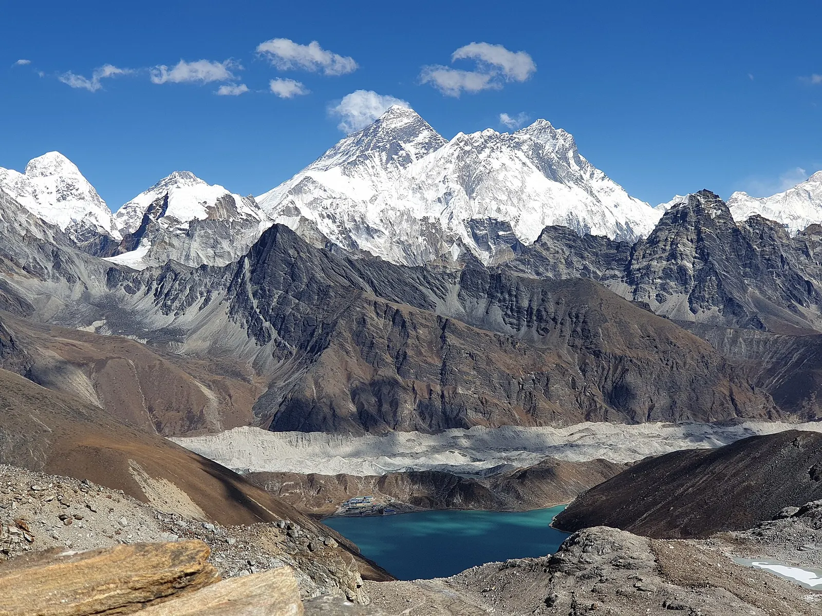
A long, demanding circuit of the Khumbu over the Kongma La, Cho La and Renjo La, all above 5,300 m, taking in Everest Base Camp, Kala Patthar, the Gokyo Lakes and the Thame valley.
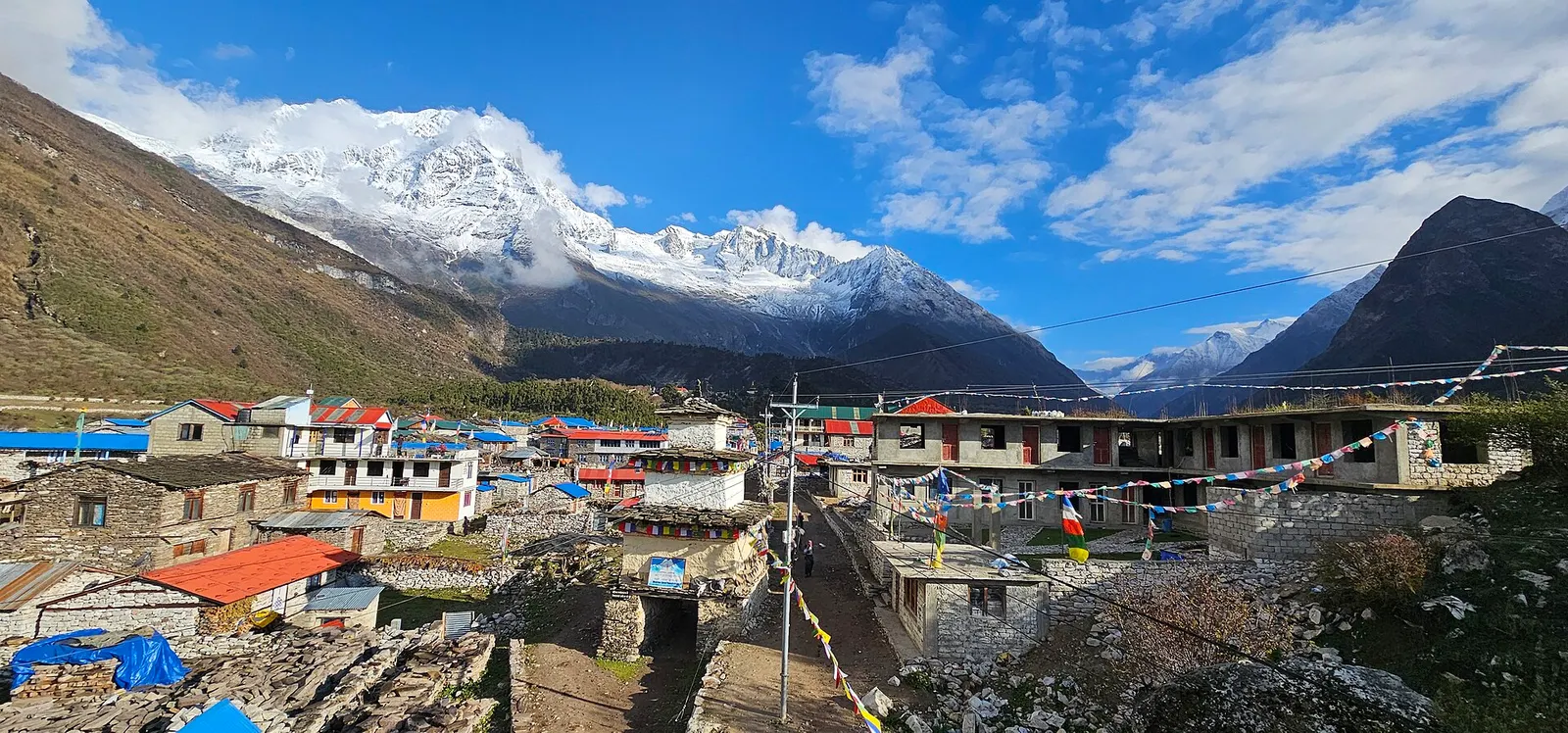
A restricted-area teahouse trek around Manaslu (8,163 m), up the Budhi Gandaki gorge through Gurung and Nubri villages, over the Larkya La (about 5,106 m) and down to Dharapani on the Annapurna Circuit.
Great Himalaya Trail · 160 days