

Valley or region
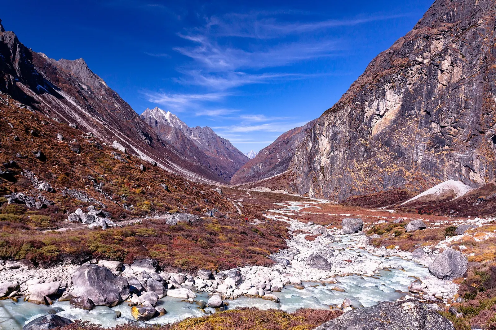
Rolwaling Valley
A remote Sherpa valley under Gaurishankar in Dolakha, trekked to the glacial lake Tsho Rolpa, with a technical pass to the Everest region.
Kathmandu Valleyदोलखा
A hill district east of Kathmandu between the Tamakoshi gorges and the Gaurishankar range, with snow pilgrimages, an old Newar town and high trekking valleys.
This page covers Dolakha District as a destination (Charikot, Kalinchowk, Dolakha Bhimsen, Sailung and Rolwaling), not only the old Dolakha bazaar.
Higher seasonal exposure: landslides (Jun-Sep), road blockages (Jun-Sep), cold (Dec-Feb).
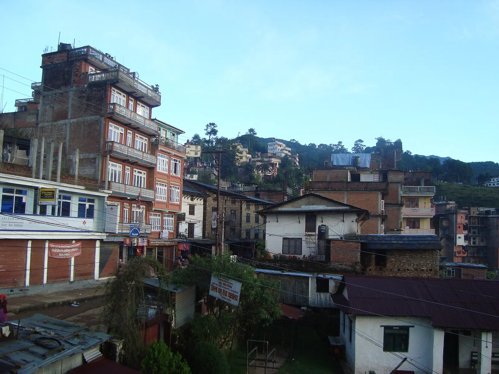
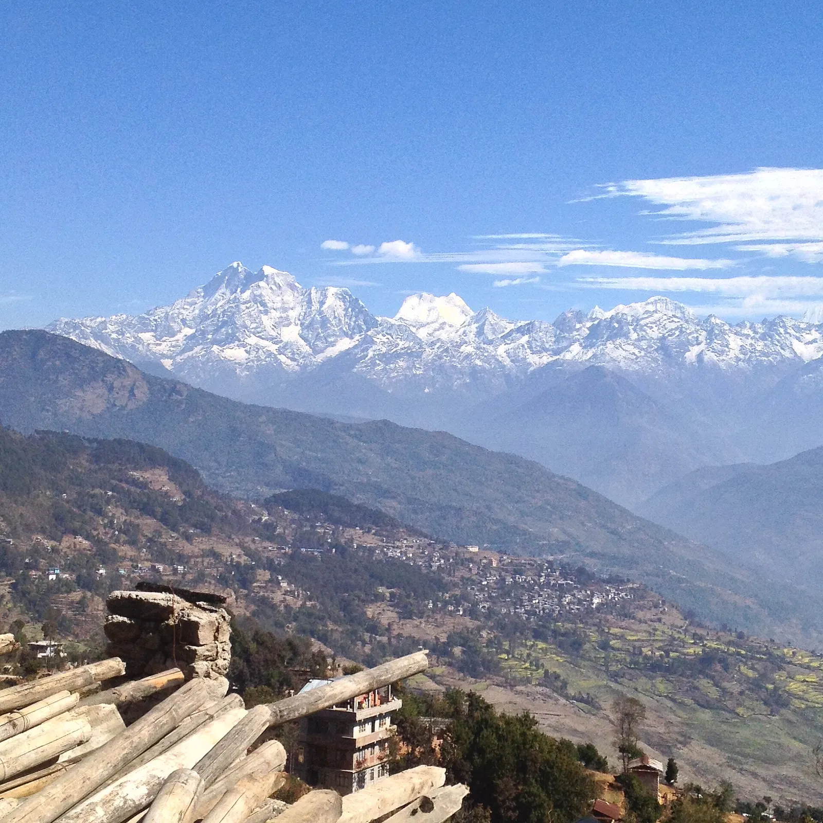
Dolakha District lies in north-eastern Bagmati Province, roughly 130-140 km by road from Kathmandu. Its headquarters, Charikot (now Bhimeshwar Municipality), sits on a ridge facing the Gaurishankar and Rolwaling peaks, while the deep valleys of the Sun Koshi and Tamakoshi rivers cut through the district below. It was the gateway for the classic walk from Jiri towards Everest before roads and flights changed travel patterns.
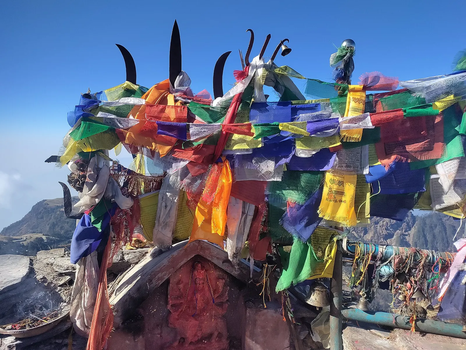
This page is the hub for four places described separately. Kalinchowk is the snowy ridge-top shrine of the goddess Kalinchowk Bhagwati at 3,842 m, reached from Kuri by a short hike or a cable car. Dolakha Bhimsen is the famous open-roofed temple in the old Newar town of Dolakha, a few kilometres from Charikot. Sailung is a hill of grassy domes on the Dolakha-Ramechhap border with a broad Himalayan view. Rolwaling is a remote Sherpa valley under Gaurishankar, reached on a multi-day trek to the glacial lake Tsho Rolpa.
Most visitors from Kathmandu come for Kalinchowk's winter snow or a temple visit, staying a night or two in Charikot or Kuri; trekkers head north to Rolwaling.
Valley or region
A remote Sherpa valley under Gaurishankar in Dolakha, trekked to the glacial lake Tsho Rolpa, with a technical pass to the Everest region.
Temple, monastery or heritage site
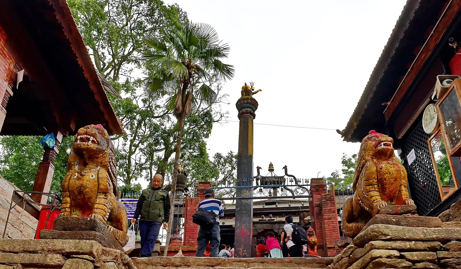
An open-roofed temple in the old Newar town of Dolakha, where a triangular stone image of Bhimsen is worshipped as a god of trade and fortune.
Temple, monastery or heritage site · 3,842 m
A Hindu shrine on a 3,842 m ridge in Dolakha, reached from Kuri on foot or by cable car, known for winter snow and mountain views.
Viewpoint · 3,146 m
A high ridge of grassy domes on the Dolakha-Ramechhap border, with a wide Himalayan view and a hilltop Shiva shrine.
The old town of Dolakha was an important Newar trading settlement on routes between the Kathmandu Valley and Tibet, and at times it was ruled as a small independent kingdom. Its temples, especially the Bhimsen temple and the Tripurasundari temple, still draw pilgrims from across Nepal. The district is also the homeland of the Thami (Thangmi) people and has large Tamang, Sherpa, Brahmin, Chhetri and Newar communities.
Dolakha was among the districts hardest hit by the 2015 earthquakes, including the strong aftershock of 12 May 2015 centred nearby, and much of Charikot and surrounding villages were rebuilt. The district also hosts the Upper Tamakoshi hydropower project, one of Nepal's largest.
Kalinchowk trip
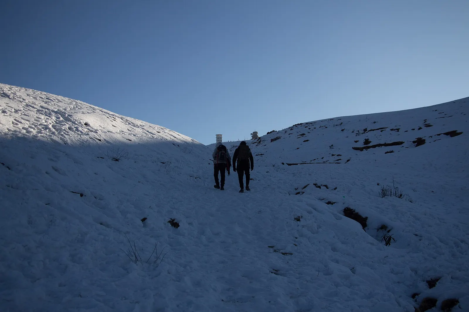
Drive to Kuri via Charikot, then hike 1-2 hours or ride the cable car to the shrine; winter brings snow.
Dolakha bazaar and Bhimsen temple
Walk the old Newar lanes of Dolakha and visit the Bhimsen and Tripurasundari temples.
Sailung hike
Spend a night near Sailung for sunrise over a long stretch of the Himalaya.
Rolwaling trek
Trek through Sherpa villages to Beding and Na and up to the glacial lake Tsho Rolpa.
Forecast for 1,848 m. Conditions change fast in the mountains.
Weather data: MET Norway, licensed CC BY 4.0. A forecast, not a guarantee.
Oct-Apr
Hotels and guesthouses in Charikot, lodges and homestays at Kuri for Kalinchowk, and simple teahouses and homestays in Rolwaling.
No partner stays are listed here yet. List a property.
Charikot is reached from Kathmandu via the Araniko Highway to Khadichaur and the Lamosangu-Jiri road, about 130-140 km and 5-7 hours.
Nearest hub: Kathmandu
Nearest hub: Kathmandu. Times are typical ranges, not schedules, and vary with roadworks, weather and the season.
By busfrom Kathmanduabout 5-7 hTourist and local buses
Buses cover the 133 km to Charikot in about six hours via the Araniko Highway and the Lamosangu to Jiri road.
When to set off: Charikot buses leave Kathmandu in the morning; the run is about six hours in good conditions.
Kalinchowk destination guide (Government of Nepal, film.gov.np)
By car or jeepfrom Kathmanduabout 5-7 h
A car or jeep on the Araniko Highway to Khadichaur, then the Lamosangu to Jiri road up to Charikot, about 133 km.
Road: Mostly sealed highway and hill road, but with steep, very slide-prone sections that are rough after monsoon damage.
When to set off: Leave Kathmandu by about 07:00 to arrive in Charikot with the afternoon free.
By motorbikefrom Kathmanduabout 5-7 hModerate riding
A popular sealed hill ride as far as Charikot; the side roads to Kuri, Sailung and the Tamakoshi are rough and better ridden in the dry months.
Road: Sealed highway and hill road to Charikot, with steep and slide-prone sections; rough earth tracks beyond.
None needed
No permit is needed for Charikot, Dolakha bazaar or Sailung. Kalinchowk and Rolwaling lie in the Gaurishankar Conservation Area, which requires a permit for foreign trekkers; some border areas need a restricted area permit.
Verify before travel: permit rules and fees change. Checked 2026-10-06 against Trekking guide to Rolwaling and Lapchi valleys (Himalayan Wander Walkers).
What this place is typically exposed to, and when. These are seasonal patterns, not a report on conditions now.
Landslideshigh in a typical yearJun-Sep
The Araniko Highway corridor runs under extremely steep hillsides that are very prone to landslides, and large slides after heavy rain are a recurring monsoon pattern on this route.
Road blockageshigh in a typical yearJun-Sep
Monsoon slides on the Araniko Highway and the Lamosangu to Jiri road can hold up or divert vehicles for anything from hours to weeks; a 2014 slide closed the highway for 46 days.
Coldhigh in a typical yearDec-Feb
December to February brings hard frost and deep cold at this height, with short days and lightly heated lodges; a four-season sleeping bag and down layers are normal kit.
Floodingmoderate in a typical yearJun-Sep
Monsoon rain swells the Tamakoshi, Sun Koshi and their tributaries, and landslides that dam a river can break out as a flash flood downstream.
Floodingmoderate in a typical yearAll year
Tsho Rolpa, at the head of the Rolwaling valley, is a large moraine-dammed glacial lake whose dam is considered unstable; an outburst would threaten settlements along the Rolwaling and Tamakoshi rivers, and a modern early-warning system has been planned to replace the one installed in the late 1990s.
Snowmoderate in a typical yearDec-Feb
Snow falls on the high ground of the district, including Kalinchowk and Sailung, from about December to February, and the steep tracks to Kuri can be icy after a heavy fall.
Kalinchowk destination guide (Government of Nepal, film.gov.np)
Altitudemoderate in a typical yearAll year
General information, not medical advice: above about 3,000 m altitude illness becomes a real risk. Gain sleeping height slowly, learn the symptoms of headache with nausea, breathlessness or unsteady walking, and go down if they get worse. See a doctor before travelling and carry insurance that covers helicopter evacuation. The district rises from hill valleys around Charikot to Sailung at about 3,146 m, Kalinchowk at 3,842 m and the Rolwaling villages above 3,700 m.
Check current conditions before you travel
Roads, trails, passes and flights change with the weather and with roadworks, and nothing on this page describes conditions today. Before you set off, check the Department of Hydrology and Meteorology for weather and flood warnings, the Nepal Disaster Risk Reduction Portal for incidents, and the local authority, police or your licensed operator for road, trail and flight status.
Charikot, the district headquarters, is about 130-140 km from Kathmandu, usually 5-7 hours by road.
Kalinchowk Bhagwati, the Dolakha Bhimsen temple, Sailung hill and the Rolwaling valley trek.
Snow usually falls between December and February, which is when most domestic visitors go.
Not for Charikot or Dolakha bazaar. The Gaurishankar Conservation Area, including Rolwaling and Kalinchowk, has its own permit for foreign visitors.
Temple, monastery or heritage site · 3,842 m
A Hindu shrine on a 3,842 m ridge in Dolakha, reached from Kuri on foot or by cable car, known for winter snow and mountain views.
Temple, monastery or heritage site
An open-roofed temple in the old Newar town of Dolakha, where a triangular stone image of Bhimsen is worshipped as a god of trade and fortune.
Viewpoint · 3,146 m
A high ridge of grassy domes on the Dolakha-Ramechhap border, with a wide Himalayan view and a hilltop Shiva shrine.
Valley or region
A remote Sherpa valley under Gaurishankar in Dolakha, trekked to the glacial lake Tsho Rolpa, with a technical pass to the Everest region.