Skip to content

Kathmandu Valley, Langtang Valley

Langtang Valley Trek

A road-accessed teahouse trek from Syabrubesi up the Langtang Khola to Kyanjin Gompa (about 3,870 m), with an optional climb to Tserko Ri for close views of Langtang Lirung. Check road access after the August 2026 floods.

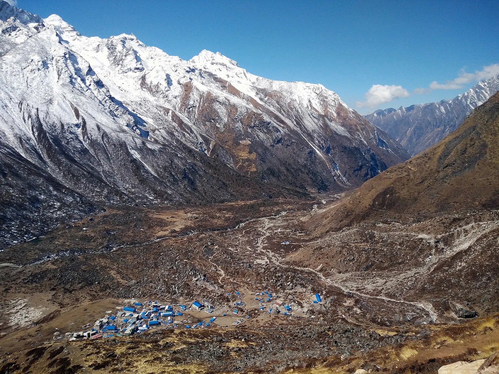
Kyanjin Gompa's blue-roofed buildings on the wide valley floor, seen from Kyanjin Ri beneath snowy Langtang peaks
Photo: Bcd4e6 (CC BY-SA 4.0)
Days
7-10
Max altitude
4,984 m
Distance
about 75 km
Difficulty
Moderate
Best months
Mar-May, Oct-Nov
Start / end
Syabrubesi / Syabrubesi
Sleep in
Teahouses
Permits
2 required

Overview

The Langtang Valley trek is the closest major Himalayan trek to Kathmandu and starts at the end of a road, so there is no mountain flight to wait for. It follows the Langtang Khola from forest into an open glacial valley inside Langtang National Park, and returns the same way.

The lower trail passes through oak, rhododendron and bamboo, home to red pandas and langur monkeys. Higher up, the valley opens out at Langtang village and Kyanjin Gompa, with yak pastures, a monastery, a small cheese dairy and day climbs to viewpoints above 4,500 m.

Langtang village was destroyed by an avalanche during the 2015 earthquake and has been rebuilt nearby; the families who returned depend on trekking. Floods reported on 26 August 2026 damaged roads in Rasuwa, the district where the trek begins, so check current access before you plan.

Kyanjin Gompa and its small cheese dairySunrise views from Kyanjin Ri or Tserko RiRebuilt Langtang village and the 2015 memorialForest with red pandas and langur monkeysNo mountain flight needed

Why it is rated moderate

  • Daily walks of 4 to 7 hours on a well-made trail, with about 1,000 m of ascent on each of the first two walking days.
  • Kyanjin Gompa is at about 3,870 m and the optional viewpoints go above 4,700 m, so altitude must be taken seriously.
  • No high passes, and the same trail is used up and down, which makes it a common first trek above 3,500 m.

Elevation profile

About altitude

Sleeping altitude for each night. The dashed lines at 3,000 m and 4,000 m mark heights where altitude illness becomes more common. General information only, not medical advice.

Hover, tap or use the arrow keys to see each day. Shaded columns are acclimatisation days.

Show the profile as a table
Sleeping altitude by day
DayOvernightSleeping altitudeHigh point
1Syabrubesi1,460 m-
2Lama Hotel2,470 m-
3Langtang village3,430 m-
4Kyanjin Gompa3,870 m-
5Kyanjin Gompa (rest)3,870 m4,984 m
6Lama Hotel2,470 m-
7Syabrubesi1,460 m-
8Kathmandu1,400 m-

Day-by-day itinerary

  1. Day 1, travel dayDrive Kathmandu to Syabrubesisleep 1,460 m

    About 7 to 11 hours by jeep or bus on a winding road via Trishuli and Dhunche, where park permits are checked. Roads in Rasuwa were damaged by floods in August 2026, so check current access and allow a spare day.

    Teahouse in SyabrubesiAbout Syabrubesi

  2. Day 2Syabrubesi to Lama Hotelsleep 2,470 m6-7 habout 11 km

    Along the river past Domen and the Pairo hot spring, then into the Langtang Khola gorge via Bamboo and Rimche, climbing steadily through forest. Watch for langurs and, with luck, red pandas.

    Teahouse in Lama HotelAbout Lama Hotel

  3. Day 3Lama Hotel to Langtang villagesleep 3,430 m6-7 habout 14 km

    Out of the forest via Riverside and Ghoda Tabela into the open valley. This day gains nearly 1,000 m; sleeping at Ghoda Tabela (about 3,000 m) is a gentler option if you feel the altitude.

    Teahouse in Langtang villageAbout Langtang village

  4. Day 4Langtang village to Kyanjin Gompasleep 3,870 m3-4 habout 7 km

    A short day past Mundu, Singdum, mani walls and chortens. Visit the monastery and the cheese dairy in the afternoon and rest for the climb ahead.

    Teahouse in Kyanjin GompaAbout Kyanjin Gompa

  5. Day 5, acclimatisationDay climb from Kyanjin Gompasleep 3,870 m4-9 habout 10 km

    Climb Kyanjin Ri (half a day) or the longer Tserko Ri (about 4,984 m, a full day of 6-9 hours) for views of Langtang Lirung and the glaciers, then return to sleep in Kyanjin. Choose the shorter climb if you have any symptoms of altitude sickness.

    Teahouse in Kyanjin GompaAbout Kyanjin Gompahigh point Tserko Ri, 4,984 m

  6. Day 6Kyanjin Gompa to Lama Hotelsleep 2,470 m6-7 habout 21 km

    Retrace the valley, mostly downhill. Fast walkers sometimes continue to Bamboo or Domen to shorten the last day.

    Teahouse in Lama HotelAbout Lama Hotel

  7. Day 7Lama Hotel to Syabrubesisleep 1,460 m5-6 habout 11 km

    Down through the forest to the road head. An afternoon soak at the hot spring is a common end to the walk.

    Teahouse in SyabrubesiAbout Syabrubesi

  8. Day 8, travel dayDrive back to Kathmandusleep 1,400 m

    About 7 to 11 hours by road. Landslides and post-flood repairs can cause long delays, so do not book an international flight for the same evening.

    Hotel in KathmanduAbout Kathmandu

Stages, times and altitudes vary by operator, weather and pace. Partner agencies confirm the exact plan.

Route map

Trail geometry from OpenStreetMap.

Mount Everest 8,848.86Kangchenjunga 8,586Dhaulagiri I 8,167Manaslu 8,163Annapurna I 8,091SyabrubesiLama HotelLangtang villageKyanjin GompaKyanjin GompaLama HotelSyabrubesiKathmandu
Boundary: Government of Nepal, Survey Department (2020). Peak data: Wikidata.

Permits

  • Langtang National Park entry permitNational park

    Sold at the Tourist Service Centre in Kathmandu or at park entry points; checked on the road near Dhunche and along the trail. The Nepal Tourism Board's fee table lists NRs 3,000 per entry for foreign visitors and NRs 1,500 for SAARC nationals.

  • TIMS cardTrekker card

    Issued through a registered trekking agency under the 2023 rule; check the current requirement.

Verify before travel: permit rules and fees change. Checked 2026-10-06 against Nepal Tourism Board: Park entry fees. Guide rule: Nepal Tourism Board: TIMS card and trekking guide rule.

Nepal trekking permits explained

When to go

Best months: Mar-May, Oct-Nov

Autumn (Sep-Nov)
October and November give the clearest views and settled weather; September can still bring monsoon cloud and landslide damage on the road.
Winter (Dec-Feb)
December to February is cold and often clear; Kyanjin Gompa is usually reachable, but snow can cover the high viewpoints and some lodges close.
Spring (Mar-May)
March to May is warmer, with rhododendrons in the lower forest; haze and afternoon cloud increase towards May.
Monsoon (Jun-Aug)
June to August brings heavy rain, leeches, cloud and a high risk of landslides on the road and lower trail; most trekkers avoid it.

Getting there and back

Getting to Syabrubesi, by mode

Nearest hub: Kathmandu. Times are typical ranges, not schedules, and vary with roadworks, weather and the season.

  • By busfrom Kathmanduabout 8-11 hLocal buses

    Local and air-conditioned buses run from Macha Pokhari bus park via Trishuli and Dhunche. Allow 8 to 11 hours, more in the monsoon.

    When to set off: Buses for Rasuwa leave Kathmandu's Macha Pokhari bus park in the morning; start early, because the run takes 8 to 11 hours and longer in rain.

    Langtang Valley Trek (Wikivoyage)

  • By car or jeepfrom Kathmanduabout 7-8 h

    A hired jeep carries up to about seven people and takes roughly 7 to 8 hours via Trishuli and Dhunche.

    Road: A steep hill road that varies from reasonable blacktop to rough, broken sections; a jeep or 4WD is the usual choice and the climb is slide-prone in the monsoon.

    When to set off: Leave Kathmandu by about 06:00 so the long hill section is driven in daylight.

    Langtang Valley Trek (Wikivoyage)

  • By motorbikefrom Kathmanduabout 7-9 hExperienced riders only

    A long, rough hill ride for experienced riders only; carry spares and avoid it in the monsoon.

    Road: Steep hill road described as anything from okay to horrible, with loose and broken sections.

    Langtang Valley Trek (Wikivoyage)

  • On footfrom DhuncheA day on foot from Dhunche, either via Thulo Syabru or along the road

    Walkers also come down from Dhunche, either on the Thulo Syabru trail or along the road; no stage band is given in the sources read.

    Langtang Valley Trek (Wikivoyage)

Where people go next

  • Lama Hotelon foot, about 5.5-7 hFirst walking day up the Langtang gorge, climbing about 1,000 m.
  • Thulo Syabruon foot, about 3-4 hClimb to the ridge village for the Gosaikunda route.
  • Langtang Valleyon footSyabrubesi is the trailhead for the whole Langtang valley trek.
  • Dhuncheby car or jeepBack up the road towards Dhunche and Kathmandu.

Seasonal risks

Typical seasonal exposure along the route, merged from the stops that have a place page. Seasonal patterns only, never conditions today.

  • Landslideshigh in a typical yearJun-Sep

    The Langtang gorge is geologically active and the main trail was rerouted after the 2015 earthquake; monsoon rain loosens the slopes, so slide-prone sections are best crossed without lingering.

    Recorded for Langtang Valley, Syabrubesi, Lama Hotel, Langtang village and 2 more. Langtang Valley Trek (Wikivoyage)

  • Road blockageshigh in a typical yearJun-Sep

    Expect the Rasuwa road to be slower in the monsoon: the bus run that takes 8 to 11 hours in dry weather typically takes longer when it rains, and slides can hold vehicles up.

    Recorded for Langtang Valley, Syabrubesi, Kathmandu. Langtang Valley Trek (Wikivoyage)

  • Floodinghigh in a typical yearJun-Sep

    Syabrubesi sits on the valley floor at the Bhote Koshi and Langtang Khola confluence, where monsoon flows run high and a landslide dam breaking out upstream can send a flash flood down the river.

    Recorded for Langtang Valley, Syabrubesi, Kathmandu. Landslide damming (Nepal) (Wikipedia)

  • Altitudehigh in a typical yearAll year

    General information, not medical advice: this is high ground where altitude illness is a real risk. Gain height slowly, build in an acclimatisation day, learn the symptoms of headache with nausea, breathlessness or unsteady walking, and go down if they get worse. See a doctor before travelling and carry insurance that covers helicopter evacuation. Kyanjin Gompa is the usual acclimatisation stop before the Kyanjin Ri and Tserko Ri day hikes, which reach roughly 4,770 m and 4,980 m.

    Recorded for Langtang Valley, Langtang village, Kyanjin Gompa. Altitude sickness (Wikivoyage)

  • Coldhigh in a typical yearDec-Feb

    December to February brings hard frost and deep cold at this height, with short days and lightly heated lodges; a four-season sleeping bag and down layers are normal kit.

    Recorded for Langtang Valley, Syabrubesi, Lama Hotel, Langtang village and 2 more. Langtang National Park (Wikivoyage)

  • Avalanche terrainmoderate in a typical yearDec-Apr

    The upper Langtang valley is geologically active and avalanche paths reach the valley floor; the 2015 earthquake-triggered avalanche that destroyed Langtang village is the extreme case, while snow-loaded slopes in winter and early spring are the ordinary seasonal concern.

    Recorded for Langtang Valley, Langtang village, Kyanjin Gompa. Langtang Valley Trek (Wikivoyage)

  • Snowmoderate in a typical yearDec-Mar

    Snow covers the upper valley through winter and into March; some upper lodges shut and the high day hikes may not be practical.

    Recorded for Langtang Valley, Syabrubesi, Lama Hotel, Langtang village and 1 more. Langtang National Park (Wikivoyage)

  • Othermoderate in a typical yearJun-Sep, Dec-Apr

    From June to August the forest trails are slippery after rain, leeches are common and the mountains are usually hidden by cloud.

    Recorded for Lama Hotel, Kathmandu. Langtang National Park (Wikivoyage)
Check current conditions before you travel

Nothing here describes the Langtang Valley Trek today. Trail, road, pass and flight conditions change with the weather and with roadworks. Check the Department of Hydrology and Meteorology, the Nepal Disaster Risk Reduction Portal and the local authority or your licensed operator before and during the trek.

Weather on the route

Forecasts for start (Syabrubesi, 1,460 m), highest overnight (Kyanjin Gompa, 3,870 m), end (Kathmandu, 1,400 m). Mountain weather changes fast; check again on the day.

Weather in Syabrubesi (start)

Forecast for 1,460 m. Conditions change fast in the mountains.

Weather data: MET Norway, licensed CC BY 4.0. A forecast, not a guarantee.

Weather in Kyanjin Gompa (highest overnight)

Forecast for 3,870 m. Conditions change fast in the mountains.

Weather data: MET Norway, licensed CC BY 4.0. A forecast, not a guarantee.

Weather in Kathmandu (end)

Forecast for 1,400 m. Conditions change fast in the mountains.

Weather data: MET Norway, licensed CC BY 4.0. A forecast, not a guarantee.

Safety

Above about 3,000 m, a widely used guideline is to increase your sleeping altitude by no more than about 500 m a day and to take an extra night at the same altitude every 3 to 4 days (CDC Yellow Book; Wilderness Medical Society). This is general information, not medical advice.
Know the signs of acute mountain sickness: headache with nausea, loss of appetite, unusual tiredness, dizziness or poor sleep. Do not go higher with symptoms, and go down if they get worse. Confusion, stumbling, or breathlessness at rest are emergencies: descend at once and get help.
See a doctor before you travel, especially about any medicine for altitude, and buy travel insurance that explicitly covers trekking and helicopter evacuation up to the highest altitude of this trek.
Floods reported on 26 August 2026 caused serious damage to roads and infrastructure in Rasuwa district and near the Tibet border, around the Bhote Koshi and Trishuli roads to Syabrubesi and Dhunche. Check current road and trail access with a licensed agency or local authorities before you set out, and build spare days into your plan.
The valley is prone to landslides, particularly from June to September and after heavy rain. Do not linger on signed landslide sections or below unstable slopes.
Tserko Ri is a long, high day. Start early, go with your guide and turn back if the weather changes or anyone feels unwell.

What to pack

  • Broken-in trekking boots
  • Warm down jacket for evenings at Kyanjin Gompa
  • Sleeping bag rated for nights below freezing
  • Waterproof shell for rain and wind
  • Sunglasses and sun cream for the high viewpoints
  • Water purification tablets or a filter
  • Cash in rupees for the whole trek
  • Copies of your park permit and TIMS card
Full trekking gear list

Side trips and alternatives

  • Kyanjin Ri and Tserko Ri

    Half-day and full-day climbs above Kyanjin Gompa for views of Langtang Lirung and the glaciers.

  • Langshisa Kharka

    A long day walk further up the valley to yak pastures with views of the upper Langtang glaciers; return to Kyanjin.

  • Gosaikunda lakes

    Extend the trek from Lama Hotel via Thulo Syabru and Sing Gompa to the sacred lakes, adding 3-4 days.

Langtang Valley questions

How many days do I need for the Langtang Valley trek?

About 7 to 8 days from Kathmandu, including the drives. Add a day or two to explore further up the valley, or 3 to 4 days to combine it with Gosaikunda.

Is the Langtang Valley trek open after the August 2026 floods?

Floods on 26 August 2026 damaged roads and infrastructure in Rasuwa. Check the current state of the road to Syabrubesi and the trail with a licensed agency before you book.

Do I need a guide for Langtang?

The Nepal Tourism Board lists the Langtang Trek among routes that require a licensed guide and an agency-issued TIMS card under the 2023 rule. Confirm the current rule before you go.

Is Langtang easier than Everest or Annapurna Base Camp?

It is shorter and its highest night is lower (about 3,870 m), which makes it a common first high trek. The optional climbs to Kyanjin Ri or Tserko Ri are still demanding.

What permits do I need?

A Langtang National Park entry permit and a TIMS card, both arranged in Kathmandu; the park permit is checked near Dhunche.

Similar treks

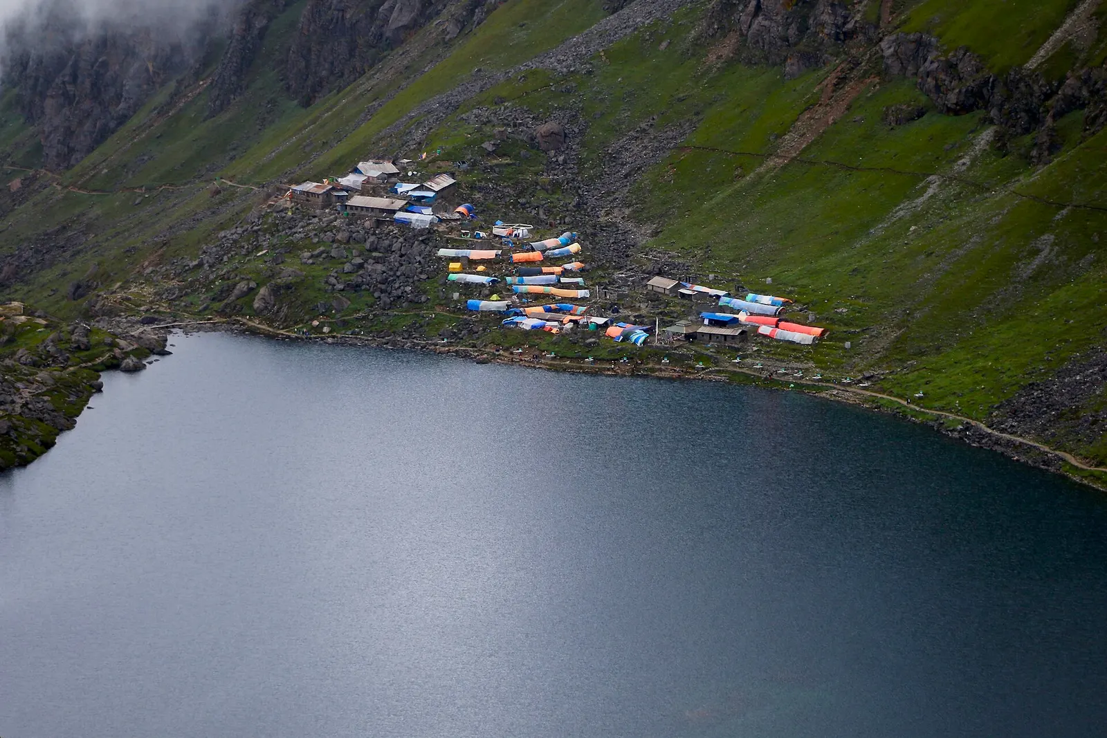
The dark water of Gosaikunda lake with a cluster of lodges with coloured roofs on the green slope above its shore.

The Langtang Valley to Kyanjin Gompa combined with the climb to the sacred Gosaikunda lakes (about 4,380 m) via Thulo Syabru and Sing Gompa, finishing at Dhunche. Check road access after the August 2026 floods.

Days
11 days
Maximum altitude
4,984 m
Difficulty
Strenuous
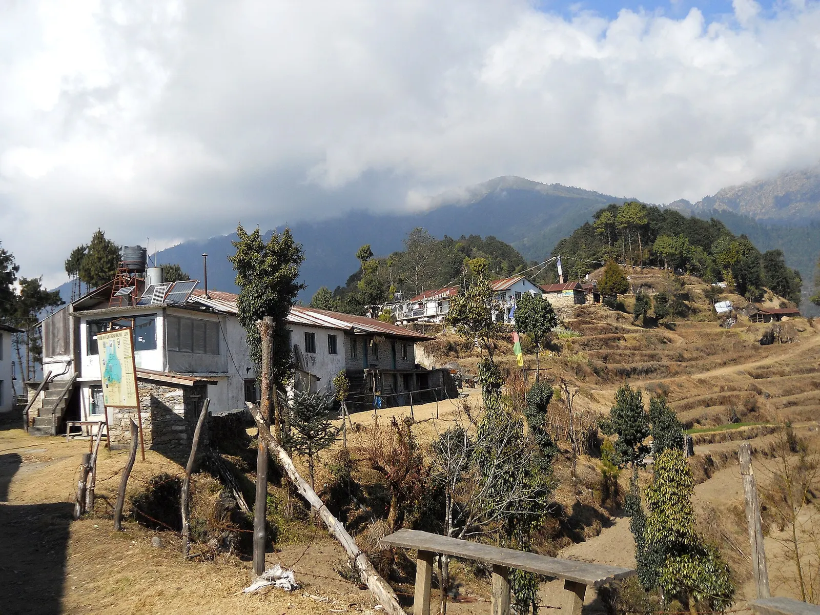
Houses and lodges of Kutumsang on a terraced ridge with pine trees and forested hills behind.

A short trek that starts on the edge of Kathmandu at Sundarijal and follows forested ridges to Tharepati (about 3,650 m), then visits the Hyolmo villages of Melamchi Gaon, Tarkeghyang and Sermathang before a drive back.

Days
7 days
Maximum altitude
3,650 m
Difficulty
Moderate
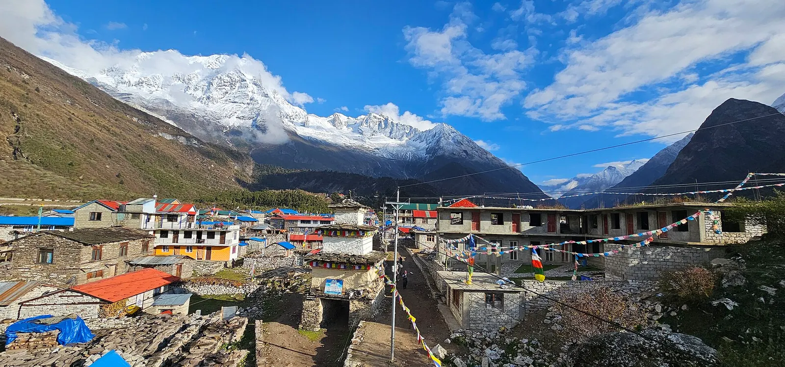
Stone houses and lodges of Samagaun with blue and red roofs, below snow-capped peaks of the Manaslu range.

A restricted-area teahouse trek around Manaslu (8,163 m), up the Budhi Gandaki gorge through Gurung and Nubri villages, over the Larkya La (about 5,106 m) and down to Dharapani on the Annapurna Circuit.

Days
12 days
Maximum altitude
5,106 m
Difficulty
Strenuous
Editorial draft: altitudes, permits and rules are being checked against the sources below. Last checked 2026-10-06. Sources: Langtang Valley Trek, Wikivoyage, Langtang National Park, Wikivoyage (26 August 2026 flood warning), Nepal Tourism Board: Park entry fees, Nepal Tourism Board: TIMS card and trekking guide rule

Langtang Valley · 8 days