Skip to content

Dolakhaरोल्वालिङ उपत्यका

Rolwaling Valley

A remote Sherpa valley under Gaurishankar in Dolakha, trekked to the glacial lake Tsho Rolpa, with a technical pass to the Everest region.

Plan a trip here
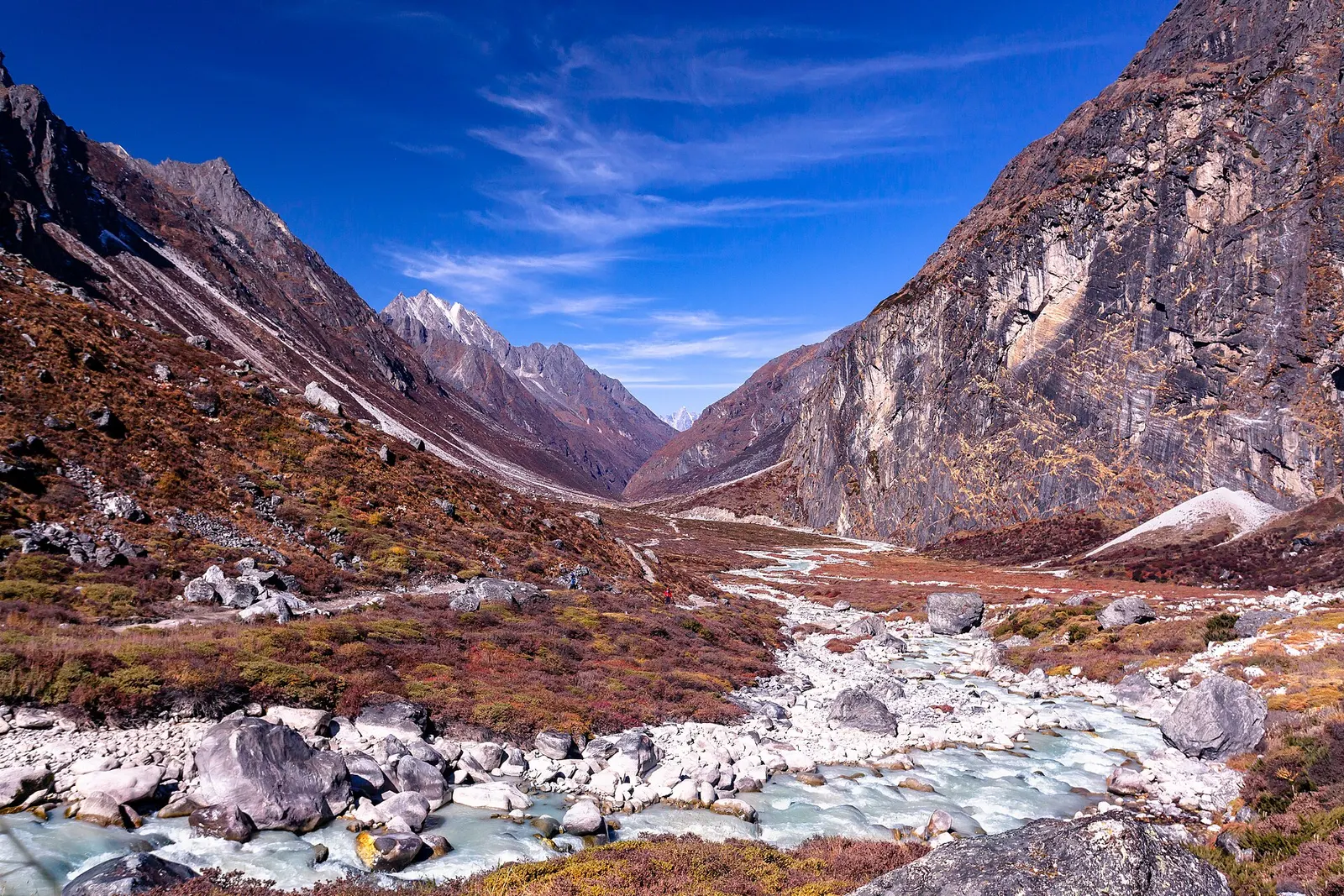
The Rolwaling river winding through the high Na valley below snow peaks.
Photo: Nammy Hang Kirat (CC BY-SA 4.0)
Altitude
-*
Best months
Apr-May, Oct-Nov
Type
Valley or region
District
Dolakha, Bagmati
Permit
Permit required

Higher seasonal exposure: altitude (All year), landslides (Jun-Sep), road blockages (Jun-Sep), snow (Dec-Apr), cold (Nov-Mar).

Why go

The Rolwaling valley runs east-west below the Rolwaling Himal in northern Dolakha, close to the Tibet border and just west of the Khumbu (Everest) region. Gaurishankar (7,134 m) and Melungtse rise above its southern and northern flanks, and the valley ends in glaciers and the large moraine-dammed lake Tsho Rolpa at about 4,580 m. It is part of the Gaurishankar Conservation Area and the wilder of the Dolakha hub's places.

Treks usually start at road heads north of Charikot, such as Chhetchhet or Simigaun, then follow the Rolwaling Khola gorge up through forest to the Sherpa villages of Beding (about 3,690 m) and Na (about 4,180 m), the last settlement. From Na, trekkers walk up to Tsho Rolpa and return, typically in about 10-14 days in total. Strong, experienced parties with mountaineering support can cross the Tashi Lapcha pass (about 5,755 m) into the Khumbu, a serious glacier route rather than a trekking pass.

Lodges are fewer and simpler than on the main trekking routes, and many groups still camp. That keeps numbers low and the valley quiet.

History and culture

Rolwaling is regarded in Tibetan Buddhism as a beyul, a hidden valley blessed by Guru Padmasambhava as a refuge for practice, and it is also sacred to Hindus because of Gaurishankar, named after Shiva and Parvati. The Sherpa communities of Beding and Na belong to several distinct clans and keep monasteries, festivals and seasonal herding traditions; Na is largely a summer settlement for yak herding.

The first Western exploration of the valley was by Eric Shipton's party in 1951, during the Everest reconnaissance. Tsho Rolpa became known internationally in the 1990s as one of Nepal's most dangerous glacial lakes, and its water level was lowered through an engineered outlet completed around 2000 to reduce flood risk downstream.

Things to do in Rolwaling Valley

  • Tsho Rolpa trek

    Trek from the road head up the Rolwaling gorge to Beding and Na, then day-walk to Tsho Rolpa; allow about 10-14 days return.

  • Acclimatisation walks around Na

    Climb viewpoints above Na for glacier and peak views before going to the lake.

  • Tashi Lapcha crossing (experienced only)

    With mountaineering equipment, a climbing guide and acclimatisation, cross the 5,755 m pass towards Thame in the Khumbu.

Weather and the best time to visit Rolwaling Valley

Weather in Rolwaling Valley (representative point)

Forecast for 4,332 m. Conditions change fast in the mountains.

Weather data: MET Norway, licensed CC BY 4.0. A forecast, not a guarantee.

Best time to visit

Apr-May, Oct-Nov

  1. Jan
  2. Feb
  3. Mar
  4. Good month: Apr
  5. Good month: May
  6. Jun
  7. Jul
  8. Aug
  9. Sep
  10. Good month: Oct
  11. Good month: Nov
  12. Dec
Autumn (Sep-Nov)
October and November are the main trekking months, with stable, clear weather.
Winter (Dec-Feb)
Very cold at Na and the lake; snow can block upper trails and Na is largely empty.
Spring (Mar-May)
April and May are good, with rhododendron in the lower forests and warmer days.
Monsoon (Jun-Aug)
Heavy rain, landslides in the gorge, leeches and cloud; not recommended.

Where to stay

TeahousesHomestaysCamping

Basic teahouses and homestays in the main villages; many groups camp, especially on the upper route and for the Tashi Lapcha.

No partner stays are listed here yet. List a property.

Getting there

Drive from Kathmandu via Charikot to a road head in the Tamakoshi valley, then trek up the Rolwaling gorge.

Nearest hub: Charikot

  • jeepKathmandu to Chhetchhet or Simigaun area road heads, about 8-10 hours by jeep or bus.
  • trekRoad head to Beding in about 2-3 days, Beding to Na in about 1 day, and Na to Tsho Rolpa as a long day trip.

Getting to Rolwaling Valley, by mode

Nearest hub: Dolakha. Times are typical ranges, not schedules, and vary with roadworks, weather and the season.

  • By busfrom Kathmanduabout 5-7 hLocal buses

    Buses run as far as Charikot and the Tamakoshi valley; onward travel to the roadheads is by jeep.

    When to set off: Charikot buses leave Kathmandu in the morning.

    Kalinchowk destination guide (Government of Nepal, film.gov.np)

  • By car or jeepfrom Kathmanduabout 8-10 h

    By jeep via Charikot and north up the Tamakoshi towards the Singati, Gongar, Chhetchhet and Simigaun roadheads; how far vehicles get varies with the state of the road.

    Road: Sealed to Charikot, then a rough, narrow and very slide-prone valley road up the Tamakoshi; a jeep is normally needed.

    When to set off: Leave Kathmandu by 05:30 to 06:00: this is a very long jeep day and the valley road is slow.

    Araniko Highway (Wikipedia)

  • By motorbikefrom DolakhaNot recommended

    The Tamakoshi valley road is rough, exposed and slide-prone; not a sensible ride, and the trek itself is on foot.

    Road: Rough, narrow and slide-prone valley road north of Charikot.

    Araniko Highway (Wikipedia)

  • On footfrom DolakhaAbout 2-3 days from the roadhead to Beding, a day on to Na, then Tsho Rolpa as a long day trip

    On foot from the roadhead up the Rolwaling gorge to Beding and Na, then a long day to Tsho Rolpa. The Tashi Lapcha pass at 5,755 m links the valley to the Khumbu and is a mountaineering crossing.

    When to set off: Start each stage early; the gorge trail is long and the upper valley clouds over by afternoon.

    Rolwaling Valley (Wikipedia)

Where people go next

  • Dolakhaby car or jeep, about 8-10 hBack down the Tamakoshi to Charikot and the highway.
  • Kalinchowk Bhagwatiby car or jeepThe district's other main high destination.
  • Namche Bazaaron footOver the Tashi Lapcha pass at 5,755 m into the Khumbu; a mountaineering crossing, not a teahouse trail.
Mount Everest 8,848.86Kangchenjunga 8,586Dhaulagiri I 8,167Manaslu 8,163Annapurna I 8,091Rolwaling ValleyKathmandu
Boundary: Government of Nepal, Survey Department (2020). Peak data: Wikidata.

Permits and fees

Permit required

The Rolwaling valley is in the Gaurishankar Conservation Area, which requires a conservation area permit. Some neighbouring areas (such as Lapchi) are restricted and need a special permit. Check whether a TIMS card is currently required.

  • Gaurishankar Conservation Area permit: Required for trekking in Rolwaling.
  • Restricted area permit: Needed only for designated restricted wards, for example the Lapchi area; check before planning side trips.

Verify before travel: permit rules and fees change. Checked 2026-10-06 against Trekking guide to Rolwaling and Lapchi valleys (Himalayan Wander Walkers).

On the trail

On the Rolwaling Valley and Tsho Rolpa trek, Tashi Lapcha crossing to the Khumbu.

Previous stop:
Beding (about 3,690 m)
Next stop:
Na (about 4,180 m), then Tsho Rolpa
A typical day:
5-7 hours of walking per day on gorge trails and moraine, with height gains of about 400-700 m on upper stages; above Beding, slow ascent is important.

Risks and conditions

Seasonal risks around Rolwaling Valley

What this place is typically exposed to, and when. These are seasonal patterns, not a report on conditions now.

  • Altitudehigh in a typical yearAll year

    General information, not medical advice: this is high ground where altitude illness is a real risk. Gain height slowly, build in an acclimatisation day, learn the symptoms of headache with nausea, breathlessness or unsteady walking, and go down if they get worse. See a doctor before travelling and carry insurance that covers helicopter evacuation. Beding is about 3,690 m, Na about 4,180 m, Tsho Rolpa about 4,580 m and the Tashi Lapcha crossing to the Khumbu is 5,755 m.

    Altitude sickness (Wikivoyage)

  • Landslideshigh in a typical yearJun-Sep

    The Araniko Highway corridor runs under extremely steep hillsides that are very prone to landslides, and large slides after heavy rain are a recurring monsoon pattern on this route.

    Araniko Highway (Wikipedia)

  • Road blockageshigh in a typical yearJun-Sep

    Monsoon slides on the Araniko Highway and the Lamosangu to Jiri road can hold up or divert vehicles for anything from hours to weeks; a 2014 slide closed the highway for 46 days.

    Araniko Highway (Wikipedia)

  • Snowhigh in a typical yearDec-Apr

    Snow lies deep in the upper valley and on the Tashi Lapcha pass through winter and early spring, when the high ground is often impractical and Na is largely empty.

    Rolwaling Valley (Wikipedia)

  • Coldhigh in a typical yearNov-Mar

    Nights at Na and the lake are severely cold from November to March, with little shelter and few lodges working.

    Rolwaling Valley (Wikipedia)

  • Floodingmoderate in a typical yearAll year

    Tsho Rolpa, at the head of the Rolwaling valley, is a large moraine-dammed glacial lake whose dam is considered unstable; an outburst would threaten settlements along the Rolwaling and Tamakoshi rivers, and a modern early-warning system has been planned to replace the one installed in the late 1990s.

    Tsho Rolpa (Wikipedia)

  • Floodingmoderate in a typical yearJun-Sep

    Monsoon rain swells the Tamakoshi, Sun Koshi and their tributaries, and landslides that dam a river can break out as a flash flood downstream.

    Landslide damming (Nepal) (Wikipedia)

Check current conditions before you travel

Roads, trails, passes and flights change with the weather and with roadworks, and nothing on this page describes conditions today. Before you set off, check the Department of Hydrology and Meteorology for weather and flood warnings, the Nepal Disaster Risk Reduction Portal for incidents, and the local authority, police or your licensed operator for road, trail and flight status.

Practical tips

  • Altitude sickness is a real risk above about 3,000 m; climb gradually, plan rest days at Beding and Na, and descend if symptoms worsen (general information, not medical advice).
  • Carry enough cash from Kathmandu or Charikot; there are no ATMs in the valley.
  • Mobile coverage is limited or absent in upper Rolwaling; consider a satellite messenger.
  • Since April 2023 foreign trekkers in national parks and conservation areas are generally required to go with a licensed guide; check the current rule.
  • Treat the Tashi Lapcha as a mountaineering route; do not attempt it without experience, equipment and a qualified guide.

Treks through Rolwaling Valley

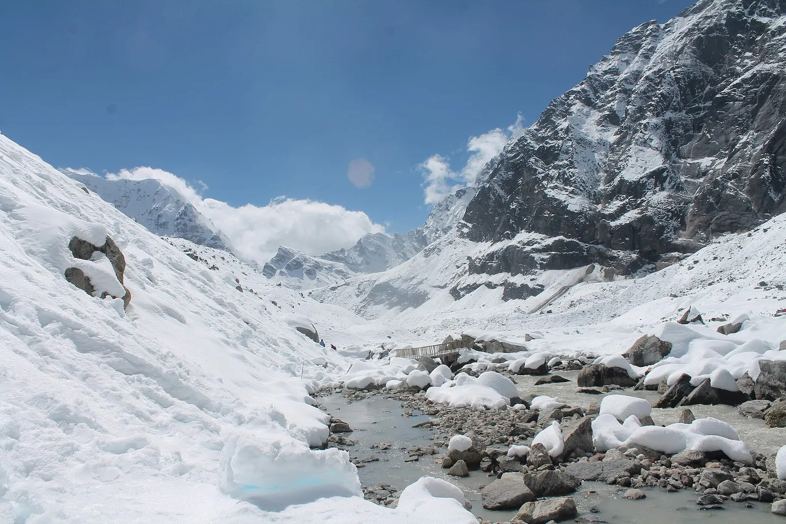
A snow-covered valley with a glacial stream and small footbridge at Makalu Base Camp, below steep rock walls.

A network of high and mid-hill routes about 1,700 km long that crosses Nepal from Kanchenjunga in the east to Humla and the far west, usually walked in sections, or as a through-trek of about four to five months.

Days
160 days
Maximum altitude
6,160 m
Difficulty
Challenging

Questions about Rolwaling Valley

How long is the Rolwaling Valley trek?

A return trek to Tsho Rolpa usually takes about 10-14 days from Kathmandu, depending on road access and acclimatisation days.

Do I need a permit for Rolwaling?

Yes, a Gaurishankar Conservation Area permit. Restricted area permits apply only to certain nearby wards such as Lapchi.

How high does the Rolwaling trek go?

Na is about 4,180 m and Tsho Rolpa about 4,580 m, so altitude sickness is a risk and acclimatisation is needed.

Can you trek from Rolwaling to Everest?

Only via the Tashi Lapcha pass (about 5,755 m), a glaciated route that needs mountaineering skills and equipment.

More in Dolakha

All of Dolakha
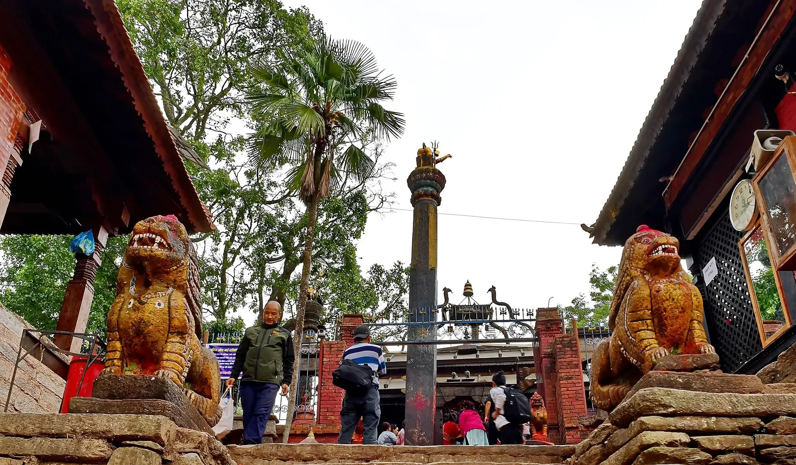
Stone lion guardians and a tall pillar at the entrance to the Dolakha Bhimsen temple.

Temple, monastery or heritage site

Dolakha Bhimsen Temple

An open-roofed temple in the old Newar town of Dolakha, where a triangular stone image of Bhimsen is worshipped as a god of trade and fortune.

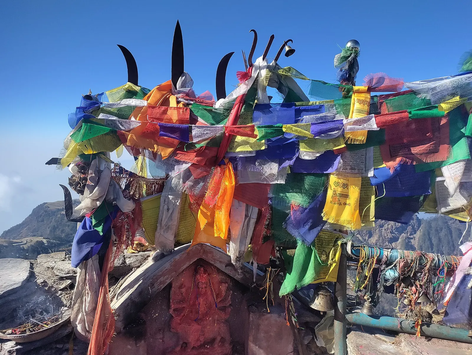
The Kalinchowk Bhagwati shrine area on the open ridge top with bells and prayer flags.

Temple, monastery or heritage site · 3,842 m

Kalinchowk Bhagwati

A Hindu shrine on a 3,842 m ridge in Dolakha, reached from Kuri on foot or by cable car, known for winter snow and mountain views.

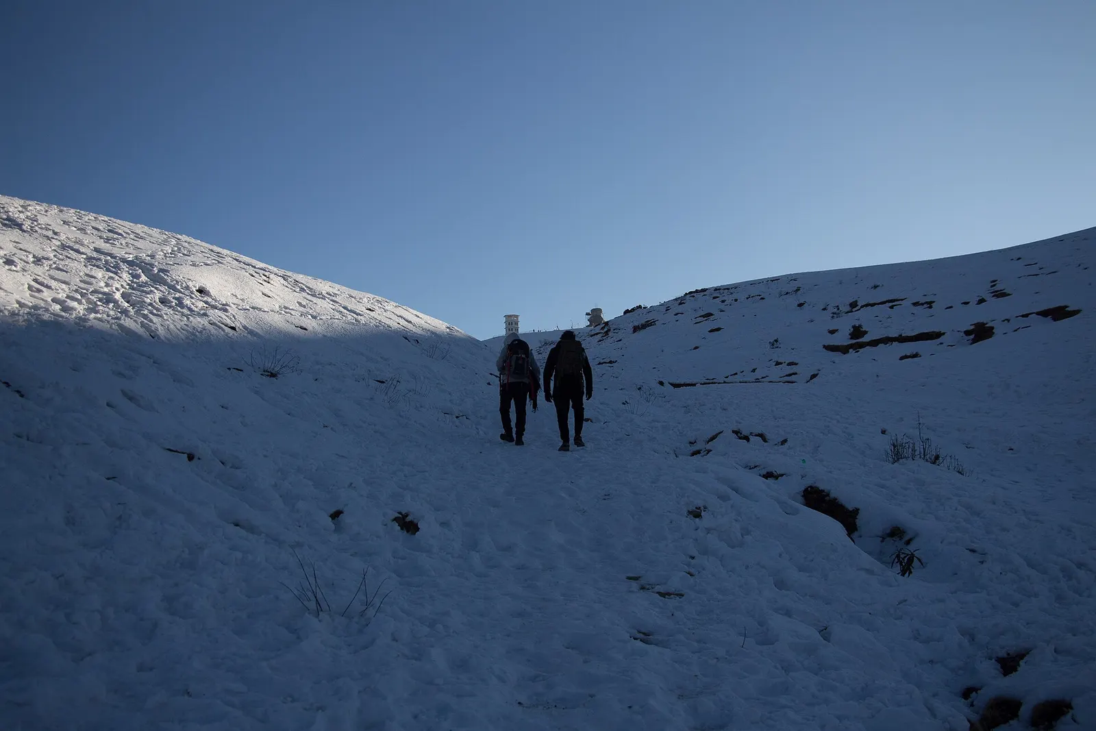
Two hikers walking up a snow-covered grassy slope towards the Sailung hilltop.

Viewpoint · 3,146 m

Sailung

A high ridge of grassy domes on the Dolakha-Ramechhap border, with a wide Himalayan view and a hilltop Shiva shrine.

Nearby

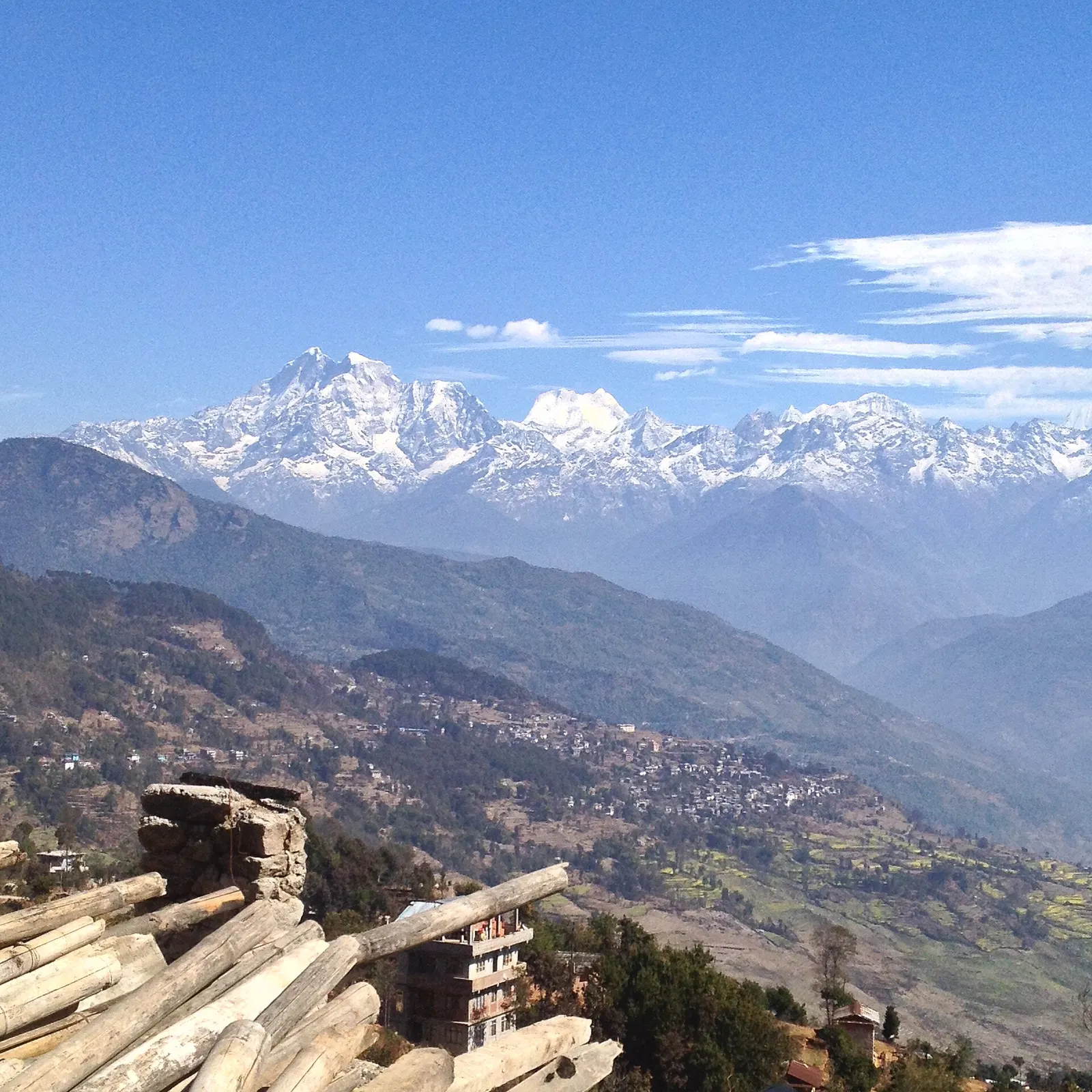
The snow peak of Gaurishankar rising above the hills, seen from Charikot.

Valley or region

Dolakha

A hill district east of Kathmandu between the Tamakoshi gorges and the Gaurishankar range, with snow pilgrimages, an old Newar town and high trekking valleys.

Valley or region

Everest Region (Khumbu)

The Sherpa homeland below Everest, reached on foot from Lukla through stone villages, monasteries and glacial valleys.

Town or village · 3,440 m

Namche Bazaar

The Sherpa market town of Khumbu, built in tiers around a hillside bowl and used by most trekkers as their acclimatisation base.

Editorial draft: facts are being checked against the sources below. Last checked 2026-10-06. Sources: Rolwaling Valley (Wikipedia), Trekking guide to Rolwaling and Lapchi valleys (Himalayan Wander Walkers), Bhimeshwar (Wikipedia)