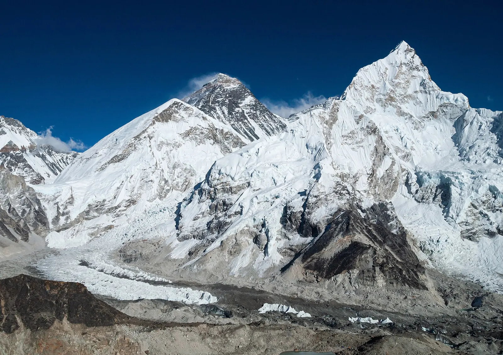
The classic teahouse trek from Lukla through Sherpa villages to Everest Base Camp (5,364 m) and the Kala Patthar viewpoint, with acclimatisation days in Namche and Dingboche.
- Days
- 12 days
- Maximum altitude
- 5,644 m
- Difficulty
- Strenuous
Everest Region (Khumbu)नाम्चे बजार
The Sherpa market town of Khumbu, built in tiers around a hillside bowl and used by most trekkers as their acclimatisation base.
Higher seasonal exposure: seasonal closure (Jun-Sep).
Namche Bazaar is the largest settlement in Khumbu and the main stop on the walk from Lukla towards Everest Base Camp and Gokyo. Its lodges, shops and bakeries are stacked in curving terraces around a horseshoe-shaped slope at about 3,440 m, with Kongde Ri rising to the west and Thamserku to the east. Within the Everest region it is the hub where the trail divides: east to Tengboche and base camp, north to Gokyo, west to Thame.
Most itineraries spend two nights here. The rest day is meant to be active: a climb of a few hundred metres to the Syangboche ridge or the Everest View area gives the first good sight of Everest, Lhotse and Ama Dablam, and a loop through Khumjung and Kunde returns the same day. In the village itself there are gear shops, pharmacies, a weekly market on Saturday mornings and some of the last reliable shops before the high trail.
Arrival is earned. From Phakding the trail follows the Dudh Kosi, crosses the river several times on suspension bridges, enters the national park near Monjo and then climbs steeply for two to three hours from the high Hillary bridge to the village.
Namche grew as a trading post on the route between Solu and Tibet over the Nangpa La, where Sherpa traders exchanged grain, salt, wool and goods. The Saturday market continues that role, with porters and traders bringing supplies up from lower valleys. Since the 1960s the town's economy has turned largely to trekking and mountaineering, and many Sherpa guides and lodge owners come from here.
The national park headquarters and visitor centre sit on the ridge above the village, with displays on Sherpa culture and mountain wildlife, and a small Sherpa cultural museum is nearby. Buddhist life is visible everywhere: a stupa and prayer wheels mark the entrance to the village, and a small monastery stands in the upper lanes. Mani Rimdu and other festivals are held at the larger monasteries further up the valley.
Acclimatisation hike
Climb about 300-400 m to the Syangboche ridge and the Everest View area for views of Everest, Lhotse and Ama Dablam, then return to sleep in Namche.
Khumjung and Kunde loop
A half to full-day circuit over the ridge to the twin Sherpa villages, the Hillary school and Khumjung monastery.
Visitor centre and museum
The park visitor centre on the ridge above town explains the mountains, wildlife and Sherpa culture.
Saturday market
Early on Saturday mornings traders set up in the lower part of the village selling food, household goods and clothing.
Forecast for 3,440 m. Conditions change fast in the mountains.
Weather data: MET Norway, licensed CC BY 4.0. A forecast, not a guarantee.
Mar-May, Oct-Nov
Namche has the widest choice of lodges in Khumbu, from basic rooms to lodges with attached bathrooms and heated dining rooms. Book ahead in October and November.
No partner stays are listed here yet. List a property.
There are no roads to Namche. Fly to Lukla and walk for about two days via Phakding, or charter a helicopter.
Nearest hub: Lukla (Tenzing-Hillary Airport)
Nearest hub: Lukla. Times are typical ranges, not schedules, and vary with roadworks, weather and the season.
By airfrom Kathmanduabout 0.4-0.7 hLukla (Tenzing-Hillary)often delayed or cancelled by weather
There is no road to Namche. Fly Kathmandu or Ramechhap to Lukla, 25-40 minutes weather permitting, then walk about two days via Phakding. Helicopters can land near the town, which matters for evacuation and charters but is no substitute for walking up slowly.
When to set off: Lukla flights are scheduled at first light, before the south-west wind builds from mid to late morning; Ramechhap departures leave Kathmandu by road around 03:00-04:00
On footfrom Phakdingabout 5-7 h5-7 h from Phakding, following the Dudh Kosi over suspension bridges then a steep 600-800 m climb through pine forest
The climb into Namche is the hardest stage of the walk in; a rest day here is the usual next move.
When to set off: teahouse stages start after breakfast, usually by 07:30, to arrive before the afternoon cloud and wind
Permit required
Namche is inside Sagarmatha National Park; a park entry permit and the Khumbu Pasang Lhamu Rural Municipality permit are needed. Check whether a TIMS card is currently required.
Verify before travel: permit rules and fees change. Checked 2026-10-06 against Department of National Parks and Wildlife Conservation.
On the Everest Base Camp trek, Gokyo Lakes trek, Three Passes trek.
What this place is typically exposed to, and when. These are seasonal patterns, not a report on conditions now.
Seasonal closurehigh in a typical yearJun-Sep
Lukla flights are the weak link in the monsoon: poor visibility stops operations at the airstrip about half the time in that season and about half of flights are cancelled, and waits of several days happen. Any itinerary built on the flight needs spare days at both ends.
Altitudemoderate in a typical yearAll year
Namche Bazaar is at about 3,440 m and is the standard first acclimatisation stop, with a rest day built into most itineraries. Acute mountain sickness is common on fast ascents - it affects roughly 40 per cent of people who go up quickly to 3,000 m, and more above that. General information, not medical advice: gain height slowly, keep sleeping-height gains small (about 300 m a day once high), build in rest days, learn the symptoms - headache, nausea, breathlessness, broken sleep - and descend if they get worse. See a doctor before travelling and carry insurance that covers helicopter evacuation.
Snowmoderate in a typical yearDec-Mar
Snow falls on the trails around the village in winter and after spring storms, though it usually clears from the lower stages within a few days.
Coldmoderate in a typical yearNov-Mar
Nights drop well below freezing from November to March, with frost most mornings and only the dining room heated in most lodges.
Othermoderate in a typical yearJun-Aug
June to August is wet: heavy rain hides the mountains, the stone staircases and bridge approaches stay slippery, and leeches are a nuisance in the forest below about 3,000 m.
River crossingsmoderate in a typical yearJun-Sep
The route crosses and recrosses the Dudh Koshi on suspension bridges between Lukla and Namche; the river runs high through the monsoon and the bridge approaches are slippery then.
Check current conditions before you travel
Roads, trails, passes and flights change with the weather and with roadworks, and nothing on this page describes conditions today. Before you set off, check the Department of Hydrology and Meteorology for weather and flood warnings, the Nepal Disaster Risk Reduction Portal for incidents, and the local authority, police or your licensed operator for road, trail and flight status.
The classic teahouse trek from Lukla through Sherpa villages to Everest Base Camp (5,364 m) and the Kala Patthar viewpoint, with acclimatisation days in Namche and Dingboche.
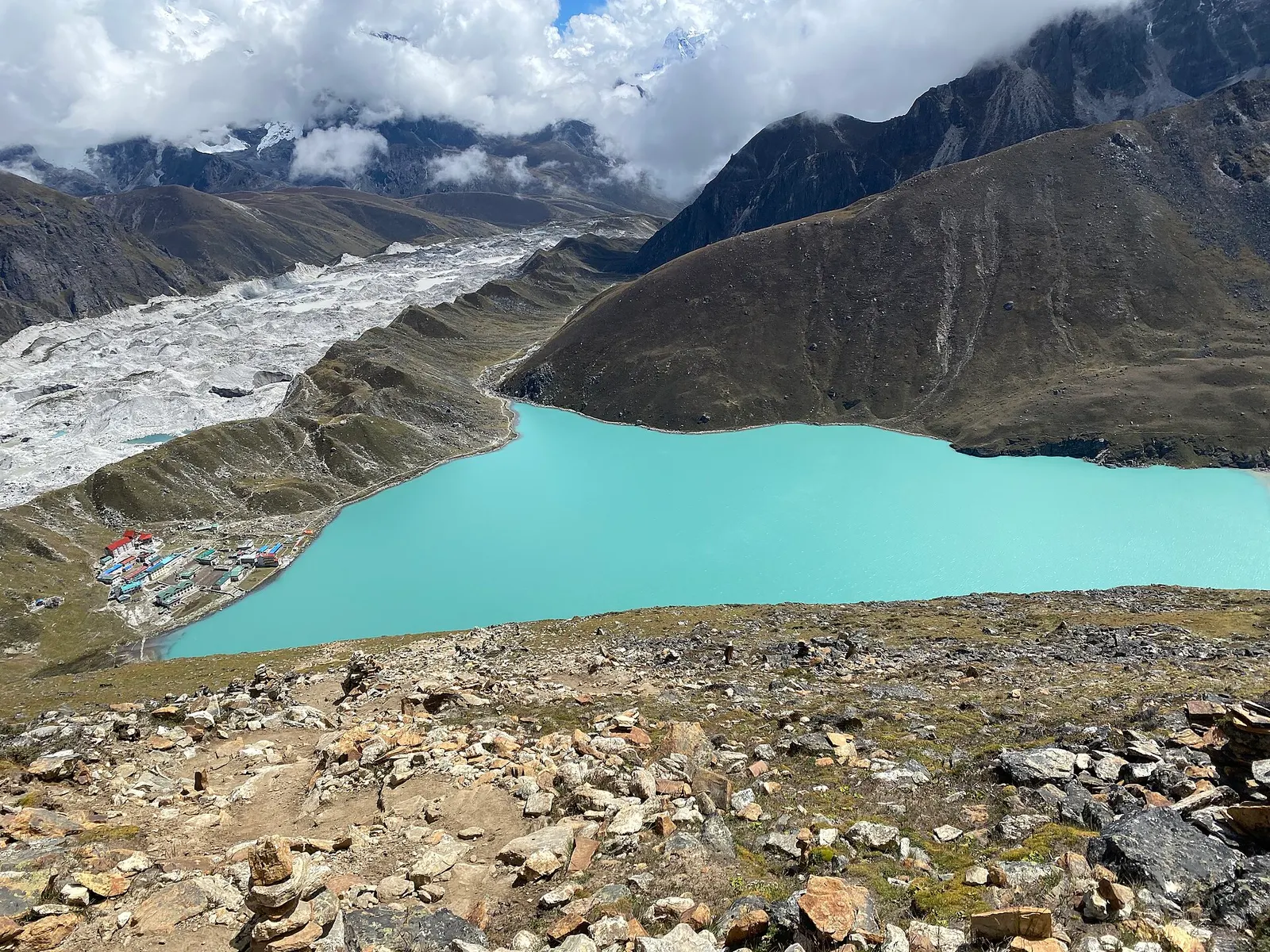
A teahouse trek from Lukla up the Dudh Kosi valley to the turquoise Gokyo Lakes beside the Ngozumpa Glacier, with a dawn climb of Gokyo Ri (about 5,357 m) for views of four 8,000 m peaks.
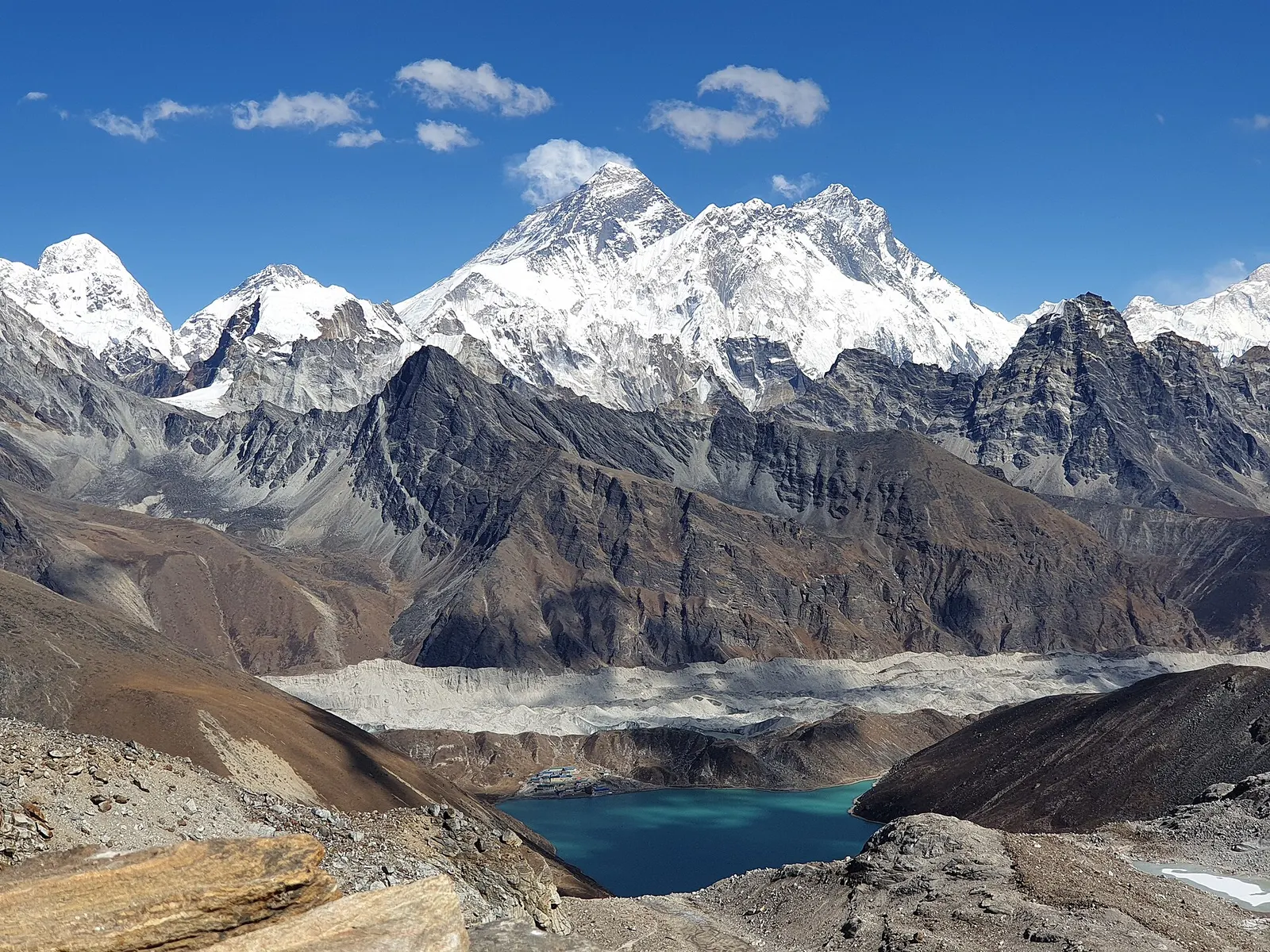
A long, demanding circuit of the Khumbu over the Kongma La, Cho La and Renjo La, all above 5,300 m, taking in Everest Base Camp, Kala Patthar, the Gokyo Lakes and the Thame valley.
Fly to Lukla, from Kathmandu or Ramechhap depending on the season, then walk about two days via Phakding.
The village is at about 3,440 m. Mild symptoms are common on arrival, which is why most itineraries include an acclimatisation day here.
Yes. It lies inside Sagarmatha National Park, so a park permit and the local Khumbu Pasang Lhamu permit are required.
Not from the village itself. A climb of about an hour to the ridge above town gives views of Everest, Lhotse and Ama Dablam on clear days.
Lake · 4,750 m
A chain of glacier-fed lakes beside the Ngozumpa glacier, with views of Everest and Cho Oyu from the hill of Gokyo Ri.
Viewpoint · 5,644 m
A dark ridge-top viewpoint above Gorak Shep with a close view of Everest, Nuptse and the Khumbu Glacier.
Viewpoint · 4,065 m
A grassy 4,065 m summit in lower Solukhumbu with a long view of the eastern Himalaya, reached on a short trek through Sherpa villages.
Trek stop · 4,730 m
A high lodge settlement at the head of the Imja valley, below Lhotse's south face and Island Peak.
Mountain pass · 5,420 m
A glaciated pass linking the Everest Base Camp trail with the Gokyo valley, crossed between Dzongla and Thagnak.
Trek stop · 4,410 m
A walled-field Sherpa village in the Imja valley, the usual acclimatisation stop on the way to Everest Base Camp.
Trek stop · 4,038 m
A small lodge village in the upper Dudh Kosi valley, the first night above Namche on the way to Gokyo.
Trek stop · 4,830 m
A tiny lodge stop on a high pasture below Cholatse, the eastern base for crossing the Cho La.
Valley or region
The Sherpa homeland below Everest, reached on foot from Lukla through stone villages, monasteries and glacial valleys.