Viewpoint · 5,140 m
Pangpema (Kanchenjunga North Base Camp)
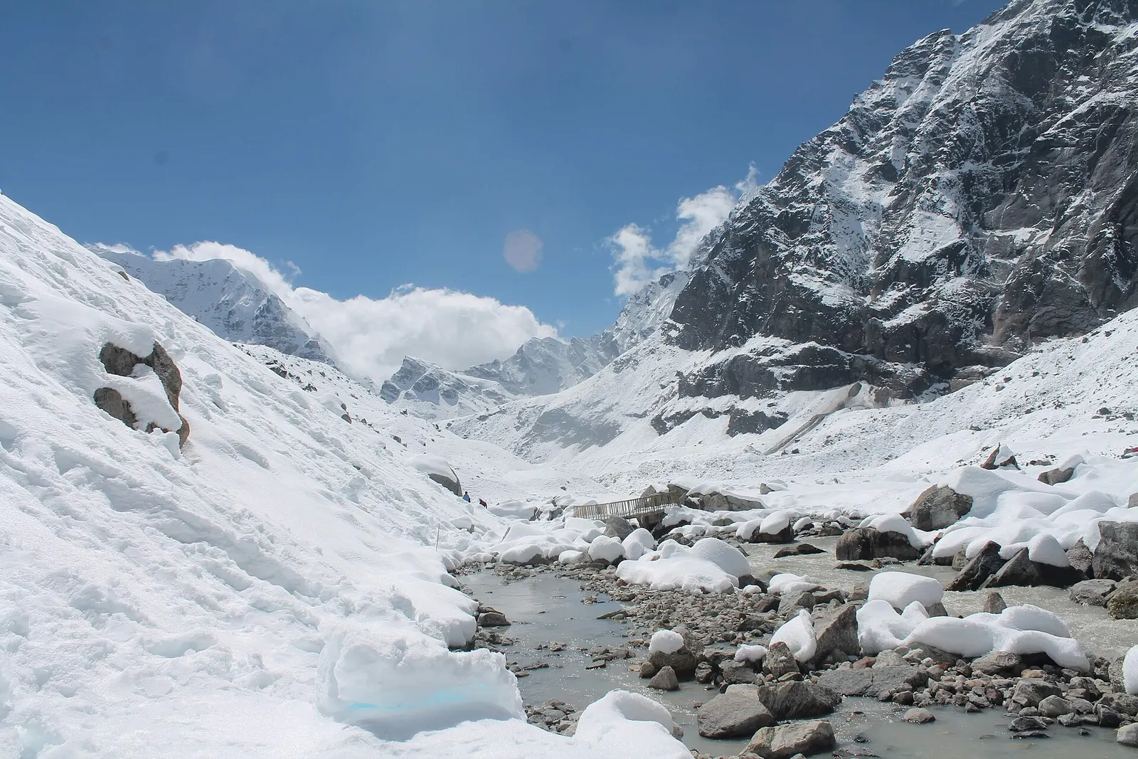
The North Base Camp of Kanchenjunga, a grassy shelf at about 5,140 m facing the mountain's north-west face.
कञ्चनजङ्घा
A remote trekking region below the world's third-highest mountain, with Limbu and Sherpa villages, two base camps and a restricted-area permit.
This is the Nepal side of Kanchenjunga, the Kanchenjunga Conservation Area and trekking region in Taplejung district, not Khangchendzonga National Park in Sikkim, India.
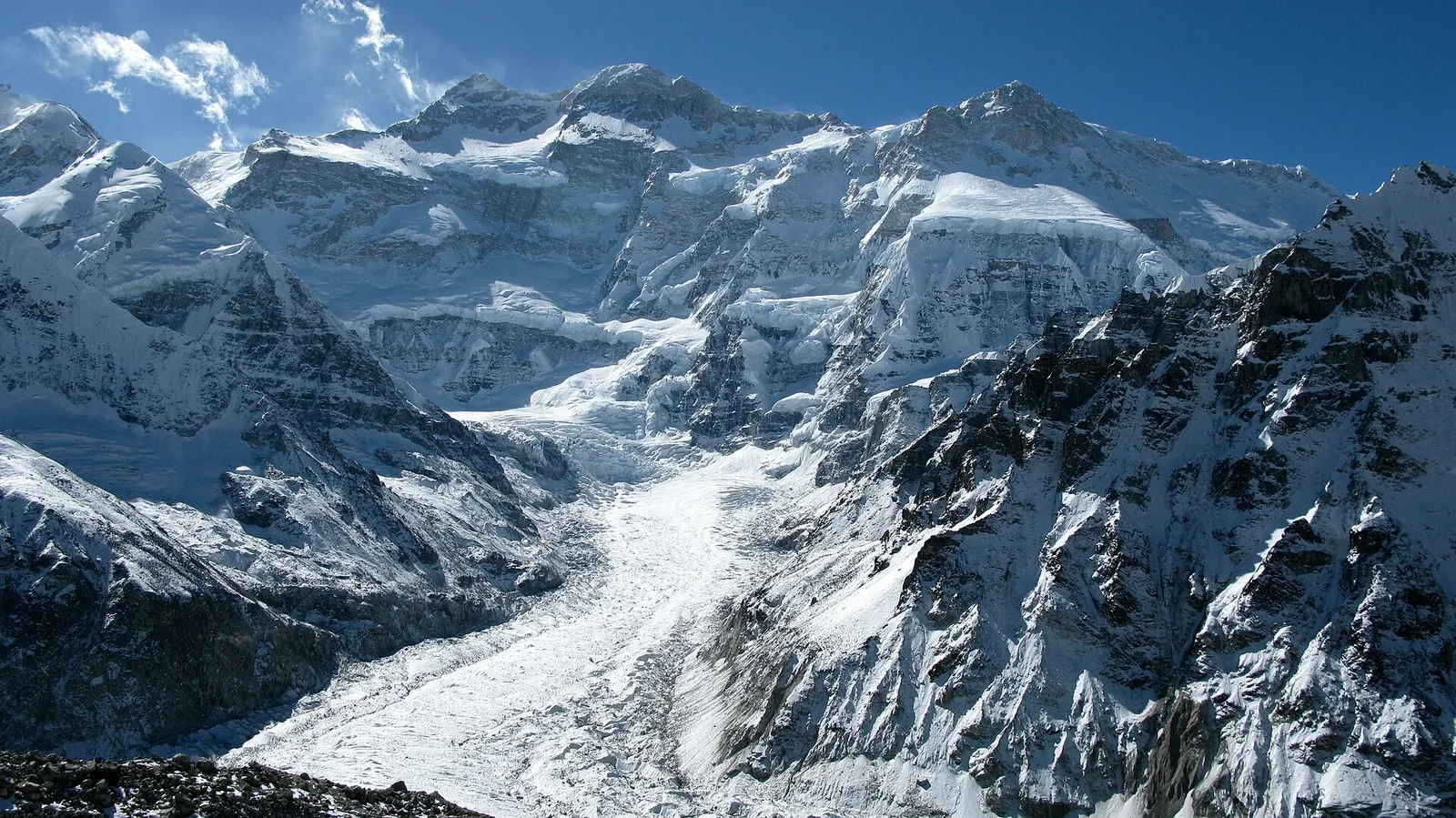
The Kanchenjunga region covers the far north-east corner of Nepal in Taplejung district, where the Kanchenjunga Conservation Area protects about 2,035 square km of forest, glaciers and high pasture below Kanchenjunga (8,586 m), the third-highest mountain on Earth. To the north it borders Tibet and to the east the Indian state of Sikkim, whose Khangchendzonga National Park protects the other side of the massif.
Treks here are long and remote. The two main goals are Pangpema, the North Base Camp at about 5,140 m beneath the vast north-west face, and Oktang near the South Base Camp, above the Yalung glacier. Most itineraries take 3-4 weeks and many link both sides as the Kanchenjunga Circuit, crossing a series of high passes (the Sele La and Sinion La area) between the Ghunsa valley and Yamphudin. Teahouses now operate on much of the route, but standards are simpler than in Khumbu or Annapurna and some trekkers still camp.
The walk passes through a wide range of country: terraced Limbu farmland and cardamom fields in the lower valleys, rhododendron and fir forest in the middle hills, then the Tibetan-influenced village of Ghunsa and the moraines and grazing grounds of Lhonak and Kambachen. The area is known for its wildlife, with snow leopard, red panda and blue sheep recorded, and camera traps have documented a leopard cat at record altitude here.
Viewpoint · 5,140 m
The North Base Camp of Kanchenjunga, a grassy shelf at about 5,140 m facing the mountain's north-west face.
Trek stop · 3,475 m
The main village of the upper Kanchenjunga valleys, a Tibetan-heritage settlement and the hub of the North Base Camp trek.
Trek stop · 4,100 m
A seasonal herding settlement at about 4,100 m facing the north side of Jannu, the second acclimatisation stop on the way to Pangpema.
Trek stop · 4,785 m
A high, sandy plain at about 4,785 m beside the Kanchenjunga glacier, the last overnight stop before Pangpema.
Town or village · 1,820 m
The hill town headquarters of Taplejung district, where Kanchenjunga treks start and finish.
Trek stop · 3,865 m
A small lodge stop at about 3,870 m in the Simbuwa Khola valley, base for Ramche and the Oktang viewpoint on the southern side of Kanchenjunga.
Trek stop · 2,080 m
A farming village of several communities at the southern gateway to Kanchenjunga, and the restricted-area checkpoint for the Oktang route.
The lower and middle valleys are home mainly to Limbu people, for whom the mountain and the hills of Taplejung are sacred in the Kirat Mundhum tradition. Higher up, Ghunsa and Olangchung Gola are settlements of Tibetan-speaking Sherpa and Walung communities who traded across the passes into Tibet. Pathibhara Devi temple on a ridge above Taplejung bazaar is one of the most important pilgrimage sites in eastern Nepal for both Hindus and Limbus, and many trekkers visit it at the start or end of the trek.
The conservation area was established in 1997 and its management was handed to a local council of community representatives in 2006, one of the first protected areas in Nepal run in this way. Because it touches the borders with Tibet and India, the upper parts of the region have long been designated restricted areas, which, together with its distance from Kathmandu, keeps visitor numbers low.
Kanchenjunga North Base Camp trek
Up the Tamor and Ghunsa valleys to Lhonak and Pangpema, typically 2.5-3 weeks return from Taplejung.
Kanchenjunga Circuit
Links North and South Base Camps across high passes, usually 3-4 weeks; needs good fitness and settled weather.
South Base Camp trek
A shorter option via Yamphudin and Tseram to Oktang, roughly 2 weeks.
Pathibhara Devi pilgrimage
A steep climb from near Taplejung to the hilltop temple at about 3,800 m; busy with pilgrims during festivals.
Forecast for 5,323 m. Conditions change fast in the mountains.
Weather data: MET Norway, licensed CC BY 4.0. A forecast, not a guarantee.
Apr-May, Oct-Nov
Simple teahouses and homestays now operate in most villages on the main routes; on the high crossings and in quiet seasons some groups still camp.
No partner stays are listed here yet. List a property.
Fly from Kathmandu to Bhadrapur or Biratnagar in the eastern plains, then drive to Taplejung; jeeps continue to road heads in the Tamor valley where the trek begins.
Nearest hub: Taplejung (Phungling)
Restricted-area permit
The upper Kanchenjunga region is a restricted area. A restricted area permit, issued only through a registered trekking agency in Nepal, and a Kanchenjunga Conservation Area permit are needed, and a licensed guide must accompany you.
Verify before travel: permit rules and fees change. Checked 2026-10-06 against Department of Immigration, Nepal: restricted areas.
A network of high and mid-hill routes about 1,700 km long that crosses Nepal from Kanchenjunga in the east to Humla and the far west, usually walked in sections, or as a through-trek of about four to five months.
A three-week restricted-area trek in far eastern Nepal that reaches both Kanchenjunga base camps, Pangpema in the north and Oktang in the south, joined by the Sele La pass crossing.
Fly to Bhadrapur or Biratnagar, drive about 9-12 hours to Taplejung, then continue by jeep to the trailhead in the Tamor valley.
Yes. You need a restricted area permit through a registered trekking agency, a Kanchenjunga Conservation Area permit and a licensed guide.
North Base Camp is usually 2.5-3 weeks return and the full circuit 3-4 weeks, including travel to and from Taplejung.
October to November and April to May. Winter closes the high passes and the monsoon brings landslides and leeches.
Pangpema is about 5,140 m, so altitude sickness is a real risk; acclimatise at Ghunsa and Kambachen.
Valley or region
A glacier-carved valley in Makalu Barun National Park, leading through forest and high pasture to the foot of Makalu.
Town or village · 1,627 m
A hill town in Nepal's far east, surrounded by tea gardens, with sunrise viewpoints towards Kanchenjunga and a sacred wetland lake.
Lake · 2,100 m
A small forest-ringed lake north of Ilam bazaar, a Ramsar wetland and a pilgrimage site for Hindus and Buddhists.
Town or village · 310 m
A lively foothill city where the plains meet the Mahabharat hills, with hilltop temples, Gurkha heritage and the road up to Bhedetar.