Skip to content

बरुण उपत्यका

Barun Valley

A glacier-carved valley in Makalu Barun National Park, leading through forest and high pasture to the foot of Makalu.

Plan a trip here
Altitude
-*
Best months
Apr-May, Oct-Nov
Type
Valley or region
District
Sankhuwasabha, Koshi
Permit
Permit required

Why go

The Barun valley is the deep, glacier-fed valley of the Barun river, a tributary of the Arun, which runs west to east below Makalu (8,463 m), the fifth-highest mountain in the world. It lies at the heart of Makalu Barun National Park, a 1,500 square km park established in 1992 as the eastern neighbour of Sagarmatha National Park. The park is known for an extreme range of altitude: from the Arun valley at a few hundred metres to the summit of Makalu, it spans forest types from subtropical to alpine within a short distance.

Visitors come mainly on the Makalu Base Camp trek, usually around 18-21 days from Kathmandu. The route climbs from the Arun valley through Rai and Sherpa villages to Tashigaon, the last permanent settlement, then crosses a high ridge at the Shipton La area before dropping into the upper Barun. The upper valley opens into broad grazing pastures such as Yangle Kharka and Langmale, with sheer granite walls and waterfalls on either side, before reaching base camp at Shershon below Makalu's south face.

Compared with Khumbu, the Barun is wild and lightly visited. There are few lodges above Tashigaon, facilities are basic, and the trail is often snowbound on the high ridge outside the main seasons.

History and culture

The lower villages are home mainly to Rai, Sherpa and other communities, many of them subsistence farmers growing millet, maize and cardamom. Surveys by the Mountain Institute in the 1980s, which began partly as an investigation into yeti reports, documented the valley's biological richness and led to the creation of the park and a community-based conservation project; the surrounding conservation area later became the park's buffer zone in 1999. Local Buddhist communities regard parts of the upper valley as a beyul, a sacred hidden valley in Tibetan Buddhist tradition, and the area is linked to Padmasambhava in local legend.

Things to do in Barun Valley

  • Makalu Base Camp trek

    Usually 18-21 days from Kathmandu via Tumlingtar, Tashigaon and the Barun valley, with acclimatisation days.

  • Wildlife and birdwatching

    The park is home to red panda, musk deer and many bird species; forests below Tashigaon and around Khongma are good for birding.

  • Viewpoints above base camp

    Day hikes above Shershon give closer views of Makalu, Baruntse and the Barun glacier.

Weather and the best time to visit Barun Valley

Weather in Barun Valley (representative point)

Forecast for 3,648 m. Conditions change fast in the mountains.

Weather data: MET Norway, licensed CC BY 4.0. A forecast, not a guarantee.

Best time to visit

Apr-May, Oct-Nov

  1. Jan
  2. Feb
  3. Mar
  4. Good month: Apr
  5. Good month: May
  6. Jun
  7. Jul
  8. Aug
  9. Sep
  10. Good month: Oct
  11. Good month: Nov
  12. Dec
Autumn (Sep-Nov)
October and November are clear and stable, the main season.
Winter (Dec-Feb)
December to February brings deep snow on the Shipton La crossing, which often makes the route impassable.
Spring (Mar-May)
April and May are warmer with rhododendrons in flower lower down; snow can linger on the high ridge into April.
Monsoon (Jun-Aug)
June to August is very wet, with leeches, swollen rivers and landslides on the access roads.

Where to stay

TeahousesHomestaysCamping

Simple teahouses and homestays run on most of the route; above Tashigaon lodges are few and very basic, and some groups camp.

No partner stays are listed here yet. List a property.

Getting there

Fly or drive to Tumlingtar in the Arun valley, take a jeep to the road head near Num or Seduwa, and walk from there.

Nearest hub: Tumlingtar

  • flightKathmandu to Tumlingtar, about 40-50 minutes.
  • roadKathmandu to Tumlingtar or Khandbari by bus or jeep is a long journey of roughly 14-18 hours.
  • jeepTumlingtar to Num or Seduwa on a rough hill road, about 4-7 hours.
  • trekRoad head to Tashigaon 1 day, then about 5-7 days to Makalu Base Camp including the high ridge crossing.
Mount Everest 8,848.86Kangchenjunga 8,586Dhaulagiri I 8,167Manaslu 8,163Annapurna I 8,091Barun ValleyKathmandu
Boundary: Government of Nepal, Survey Department (2020). Peak data: Wikidata.

Permits and fees

Permit required

A Makalu Barun National Park entry permit is required, and a local rural municipality fee may be collected. Check whether a TIMS card is currently required. The route to base camp is not a restricted area, but nearby border areas of Sankhuwasabha are.

  • Makalu Barun National Park entry permit: Check the latest rules and fees.
  • Licensed guide: Since April 2023 foreign trekkers in national parks and conservation areas are generally required to go with a licensed guide; check the current rule.
  • Restricted area permit: Only for routes into the restricted northern border areas of Sankhuwasabha, not the standard base camp trek.

Verify before travel: permit rules and fees change. Checked 2026-10-06 against Department of National Parks and Wildlife Conservation.
Practical tips

  • Makalu Base Camp is at about 4,870 m and the high ridge crossing is above 4,000 m. Acclimatise on the way up and descend if symptoms worsen. General information, not medical advice.
  • Mobile signal fades above the villages; there is no reliable coverage in the upper Barun.
  • There are no ATMs beyond Khandbari and Tumlingtar; carry all the cash you need.
  • Snow on the ridge can block the route; check conditions in Tashigaon before continuing.
  • Carry water purification, as supplies above Tashigaon are limited.

Treks through Barun Valley

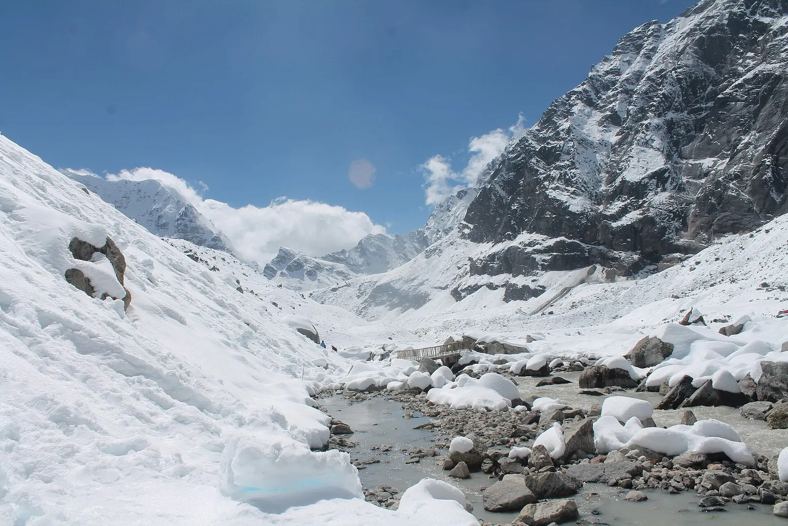
A snow-covered valley with a glacial stream and small footbridge at Makalu Base Camp, below steep rock walls.

A network of high and mid-hill routes about 1,700 km long that crosses Nepal from Kanchenjunga in the east to Humla and the far west, usually walked in sections, or as a through-trek of about four to five months.

Days
160 days
Maximum altitude
6,160 m
Difficulty
Challenging

Questions about Barun Valley

How do I get to the Barun valley from Kathmandu?

Fly to Tumlingtar, take a jeep to Num or Seduwa, then walk about a week to the upper valley and Makalu Base Camp.

Do I need a permit for the Barun valley?

Yes, a Makalu Barun National Park permit is required. The standard base camp route is not a restricted area.

How high is Makalu Base Camp?

About 4,870 m. The route also crosses a ridge above 4,000 m, so altitude sickness is a real risk.

When is the best time to visit the Barun valley?

October to November and April to May. Winter snow often blocks the high ridge and the monsoon is very wet.

Nearby

National park or conservation area

Kanchenjunga Region

A remote trekking region below the world's third-highest mountain, with Limbu and Sherpa villages, two base camps and a restricted-area permit.

Valley or region

Everest Region (Khumbu)

The Sherpa homeland below Everest, reached on foot from Lukla through stone villages, monasteries and glacial valleys.

Temple, monastery or heritage site · 1,346 m

Halesi-Maratika Caves

A limestone cave temple in Khotang held sacred by Hindus as Halesi Mahadev, by Buddhists as Maratika, and by the Kirat Rai as an ancestral place.

Editorial draft: facts are being checked against the sources below. Last checked 2026-10-06. Sources: Makalu Barun National Park, Wikipedia, Yangle Kharka, OpenStreetMap