Skip to content

Far Westलिमी उपत्यका

Limi Valley

A remote, high valley in northern Humla on the Tibetan border, with three Tibetan Buddhist villages and an 11th-century monastery.

Plan a trip here
Altitude
3,700 m*
Best months
May-Jun, Sep-Oct
Type
Valley or region
District
Humla, Karnali
Permit
Restricted-area permit

Higher seasonal exposure: other (Jun-Sep), altitude (All year), snow (Nov-Apr), cold (Nov-Mar), road blockages (Jun-Sep).

Why go

The Limi valley forms the northernmost part of Humla district in north-western Nepal, a high, dry valley on the border with the Purang area of Tibet. It is drained by the Limi river, a tributary of the Humla Karnali, and has just three permanent villages: Til, Halji and Dzang, lying between about 3,700 and 4,100 m. Fewer than a thousand people live here, farming barley and herding yak, sheep and goats.

Limi is one of the remotest trekking areas in Nepal and is visited by only a small number of trekkers each year. A loop from Simikot, the district headquarters, typically follows the Humla Karnali river upstream to Hilsa on the Tibetan border, climbs east into the valley near Til, continues through Halji and Dzang, and returns over the Nyalu La, a pass of about 4,995 m, and the Talung valley. The loop usually takes around two weeks on foot.

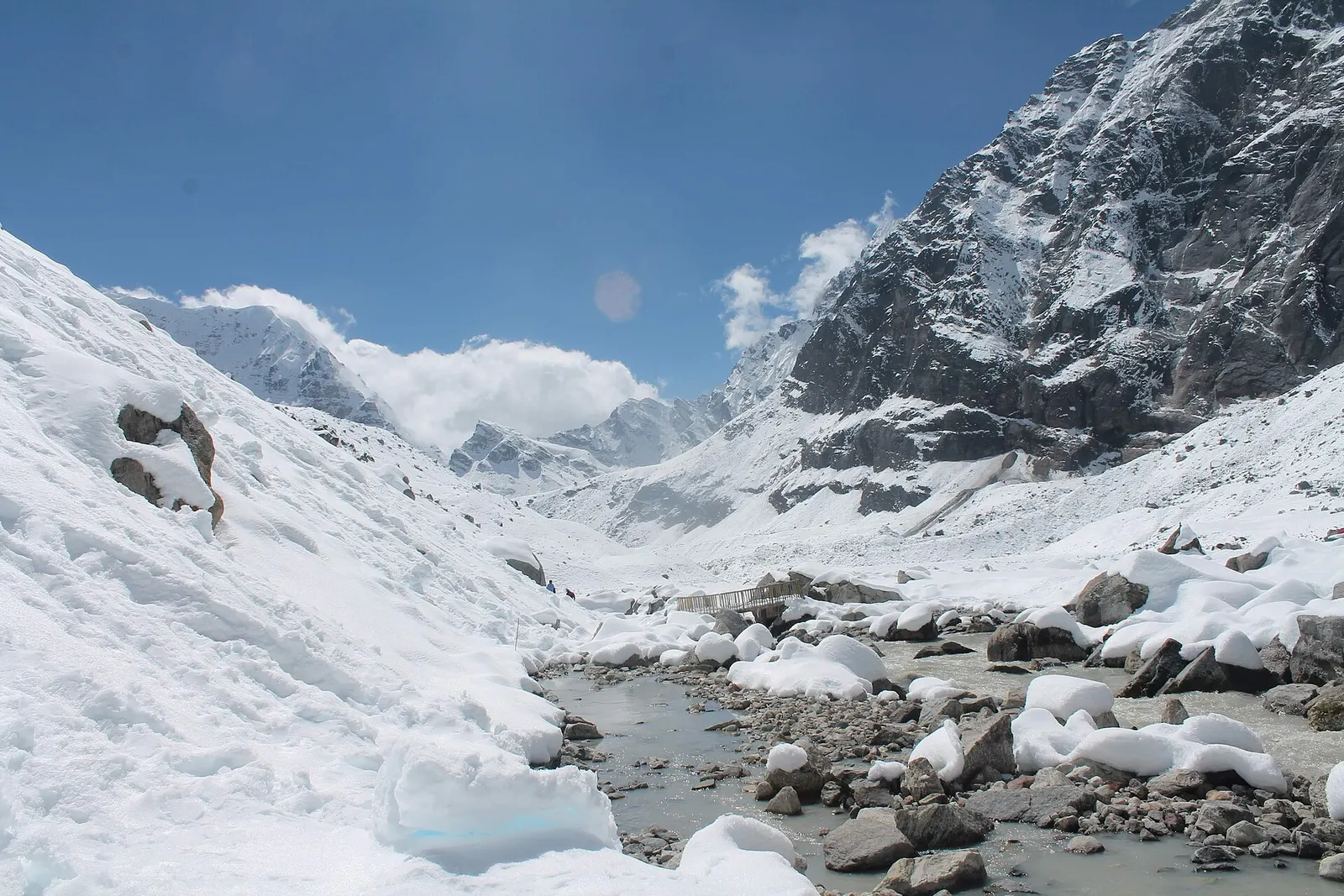
The landscape is stark and spacious: bare mountainsides, high grazing grounds, small lakes and glaciers on the slopes of the Gurla Mandhata massif. Wildlife reported here includes snow leopard, Himalayan wolf, Tibetan gazelle, kiang (Tibetan wild ass), argali, blue sheep and, since 2014, wild yak, once thought lost from Nepal. From the Lapcha La on the border, clear days show Lake Manasarovar and Mount Kailash in Tibet.
History and culture

The people of Limi follow the Drikung Kagyu school of Tibetan Buddhism, and each village has its own small gompa. The Rinchenling monastery at Halji is believed to have been founded by the 11th-century translator and scholar Rinchen Zangpo; architectural and textual evidence places its oldest parts in that century, and it is often compared with Tabo monastery in Spiti, India. The valley's culture, dress and economy have always been closely linked with neighbouring Tibet, and trade across the border remains important.

Limi has been affected by climate change: since 2004 glacial lake outburst floods have damaged parts of Halji village and come close to the monastery. A rough road now connects the eastern end of the valley near Dzang with Taklakot (Purang) in Tibet.

Things to do in Limi Valley

  • Limi valley loop

    Simikot to Hilsa, through Til, Halji and Dzang, and back over the Nyalu La, usually about 12-16 days.

  • Halji monastery

    Visit the old Rinchenling gompa; ask permission before entering and photographing.

  • Lapcha La viewpoint

    A side trip to the border pass for distant views of Kailash and Manasarovar on clear days; check current access with your guide.

Weather and the best time to visit Limi Valley

Weather in Limi Valley

Forecast for 3,700 m. Conditions change fast in the mountains.

Weather data: MET Norway, licensed CC BY 4.0. A forecast, not a guarantee.

Best time to visit

May-Jun, Sep-Oct

  1. Jan
  2. Feb
  3. Mar
  4. Apr
  5. Good month: May
  6. Good month: Jun
  7. Jul
  8. Aug
  9. Good month: Sep
  10. Good month: Oct
  11. Nov
  12. Dec
Autumn (Sep-Nov)
September and October are clear and dry; snow can close the Nyalu La from late October.
Winter (Dec-Feb)
November to March is very cold, passes are snowbound and many villagers move to lower ground; not practical for trekking.
Spring (Mar-May)
April and May are possible but snow may linger on the high passes.
Monsoon (Jun-Aug)
Limi lies in a rain shadow and is relatively dry in June to August, but flights to Simikot are often disrupted by weather further south.

Where to stay

CampingHomestays

There are very few lodges; treks are usually fully supported camping trips, with occasional homestays in the villages.

No partner stays are listed here yet. List a property.

Getting there

Fly from Nepalgunj to Simikot and walk from there. A road via the Karnali corridor is being built but is rough and incomplete.

Nearest hub: Simikot

  • flightKathmandu to Nepalgunj, about 1 hour, then Nepalgunj to Simikot, about 40-50 minutes on small planes, weather permitting.
  • trekSimikot to Hilsa along the Humla Karnali, then east into Limi, about 5-7 days to the valley.
  • trekShorter route over the Nyalu La via the Salli Khola and Talung valley, about 4-5 days from Simikot.
  • jeepSections of road along the Humla Karnali and towards Hilsa are open in parts of the year; check current conditions.

Getting to Limi Valley, by mode

Nearest hub: Simikot. Times are typical ranges, not schedules, and vary with roadworks, weather and the season.

  • By airfrom Nepalgunjabout 0.6-0.9 hSimikotoften delayed or cancelled by weather

    Small aircraft serve Simikot at about 2,818 m from Nepalgunj and Birendranagar (Surkhet). It is the main gateway on the Nepal side for Kailash and Manasarovar travel precisely because road access in Humla is weak, and the leg is weather-dependent.

    When to set off: Morning flights only; fly Kathmandu to Nepalgunj first and allow spare days at both ends.

    Simikot Airport, Wikipedia

  • By car or jeepfrom Simikot

    Sections of road along the Humla Karnali and towards Hilsa are usable in parts of the year, but the Karnali Highway corridor to Hilsa is largely unpaved and incomplete; no sourced hour band was found.

    Road: Incomplete, largely unpaved Karnali corridor road; 4WD only, and the usable season changes from year to year.

    Karnali Highway, Wikipedia

  • On footfrom SimikotAbout 4-5 days from Simikot over the Nyalu La (about 4,995 m) by the Salli Khola and Talung valleys, or 5-7 days round by the Humla Karnali and Hilsa.

    Limi is walking country: both approaches from Simikot take several days and the shorter one crosses a pass of nearly 5,000 m.

    Simikot Airport, Wikipedia

Where people go next

  • Rara Lakeby airVia Nepalgunj or Surkhet; there is no direct link between Humla and Mugu.
  • Dolpoby airVia Nepalgunj for the Juphal flight.
  • Jumlaby airVia Nepalgunj; the western airstrips connect through the lowland hub, not to each other.
Mount Everest 8,848.86Kangchenjunga 8,586Dhaulagiri I 8,167Manaslu 8,163Annapurna I 8,091Limi ValleyKathmandu
Boundary: Government of Nepal, Survey Department (2020). Peak data: Wikidata.

Permits and fees

Restricted-area permit

Northern Humla, including Simikot's surroundings and the Limi valley, is a restricted area. A restricted area permit is issued only through a registered trekking agency in Nepal, and a licensed guide must accompany you.

  • Humla restricted area permit: Covers the restricted wards of Simikot, Namkha and nearby rural municipalities, including Limi; applied for by a registered agency via the Department of Immigration.
  • Licensed guide and agency: Restricted-area trekkers must book through a registered agency with a licensed guide. Group-size rules for restricted areas were reported to have changed in 2026; check the current rule.

Verify before travel: permit rules and fees change. Checked 2026-10-06 against Department of Immigration, Nepal: restricted areas.

Risks and conditions

Seasonal risks around Limi Valley

What this place is typically exposed to, and when. These are seasonal patterns, not a report on conditions now.

  • Otherhigh in a typical yearJun-Sep

    The access is the problem, not the rain: Simikot is reached only by small aircraft from Nepalgunj or Surkhet because road access in Humla is weak, and monsoon cloud over the lowlands regularly stops these flights.

    Simikot Airport, Wikipedia

  • Altitudehigh in a typical yearAll year

    Halji is about 3,700 m, Dzang about 3,920 m, Til about 4,100 m and the Nyalu La about 4,995 m. Altitude sickness becomes common above roughly 2,500 m. General information, not medical advice: gain height slowly (a common guideline is no more than about 300 m a day in sleeping altitude once high), learn the symptoms, descend if they get worse, see a doctor before travelling, and carry insurance that covers helicopter evacuation.

    Altitude sickness, Wikipedia

  • Snowhigh in a typical yearNov-Apr

    The Nyalu La at about 4,995 m is the key crossing into the valley and holds snow from late autumn into spring; in deep winter the passes are not normally crossed.

    Simikot Airport, Wikipedia

  • Coldhigh in a typical yearNov-Mar

    Winter in Limi is severe at these altitudes and many villagers move to lower ground, so shelter and supplies thin out from November to March.

    Simikot Airport, Wikipedia

  • Road blockageshigh in a typical yearJun-Sep

    A road is being pushed along the Humla Karnali corridor towards Hilsa but it is rough and incomplete, and its usable season changes from year to year.

    Karnali Highway, Wikipedia

  • Landslideslow in a typical yearJun-Sep

    Limi lies behind the main range in a rain shadow and is relatively dry in the monsoon, so local landslide exposure is low.

    Simikot Airport, Wikipedia

Check current conditions before you travel

Roads, trails, passes and flights change with the weather and with roadworks, and nothing on this page describes conditions today. Before you set off, check the Department of Hydrology and Meteorology for weather and flood warnings, the Nepal Disaster Risk Reduction Portal for incidents, and the local authority, police or your licensed operator for road, trail and flight status.

Practical tips

  • The valley lies at 3,700-4,100 m and the Nyalu La is about 4,995 m. Acclimatise carefully and descend if symptoms worsen. General information, not medical advice.
  • There are no ATMs beyond Nepalgunj; Simikot has limited services.
  • Mobile signal is very limited; carry a satellite messenger.
  • Keep chortens and mani walls on your right and ask before photographing people and monastery interiors.
  • Simikot flights are often delayed; build several buffer days into the plan.

Treks through Limi Valley

A snow-covered valley with a glacial stream and small footbridge at Makalu Base Camp, below steep rock walls.

A network of high and mid-hill routes about 1,700 km long that crosses Nepal from Kanchenjunga in the east to Humla and the far west, usually walked in sections, or as a through-trek of about four to five months.

Days
160 days
Maximum altitude
6,160 m
Difficulty
Challenging

Questions about Limi Valley

How do I get to the Limi valley?

Fly from Nepalgunj to Simikot, then trek about 5-7 days via Hilsa, or 4-5 days over the Nyalu La.

Do I need a permit for the Limi valley?

Yes. It is a restricted area, so you need a permit through a registered trekking agency and a licensed guide.

When is the best time to visit the Limi valley?

May to June and September to October. Winter snow closes the passes.

Can you see Mount Kailash from the Limi valley?

On clear days, Kailash and Lake Manasarovar are visible from the Lapcha La on the Tibetan border.

Nearby

Lake · 2,990 m

Rara Lake

Nepal's largest lake, a deep blue sheet of water ringed by pine forest in the remote Karnali hills.

National park or conservation area · 3,000 m

Khaptad National Park

A high, rolling plateau of grassland and forest in Nepal's far west, known for its wildflower meadows and the hermitage of Khaptad Baba.

Valley or region

Dolpo

A remote trans-Himalayan region of Bon and Buddhist villages, high passes and turquoise Phoksundo Lake, behind the Dhaulagiri and Kanjiroba ranges.

Editorial draft: facts are being checked against the sources below. Last checked 2026-10-06. Sources: Limi, Wikipedia, Halji, OpenStreetMap