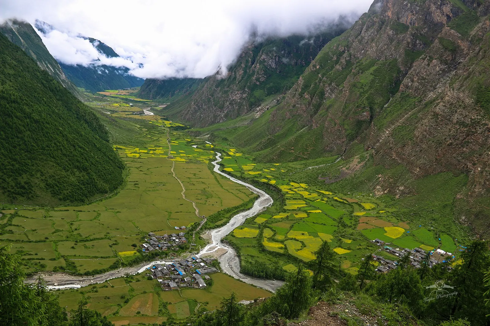
Valley or region
Tsum Valley
A restricted Buddhist side valley of the Manaslu region, with monasteries, Milarepa's cave and villages near the Tibetan border.
Manasluसोती खोला
A small roadhead settlement on the Budhi Gandaki where most Manaslu Circuit treks begin.
This is Soti Khola in Aarughat, Gorkha district, the usual starting point of the Manaslu Circuit on the Budhi Gandaki; not the Soti Khola stream and roadside area near Gajuri in Dhading.
Higher seasonal exposure: landslides (Jun-Sep), road blockages (Jun-Sep), river crossings (Jun-Sep).
Soti Khola is a cluster of lodges and houses where the Soti Khola stream joins the Budhi Gandaki, a few hours' drive north of Arughat in Gorkha district. For most trekkers it is where the jeep or bus ride from Kathmandu ends and the Manaslu Circuit begins on foot, so its role in the Manaslu destination is as the gateway rather than a sight in itself.
At only a few hundred metres above sea level, it is warm and green, with sal forest, terraced rice fields and a steep, narrow river valley. Beyond it the trail follows the Budhi Gandaki upstream past waterfalls and suspension bridges towards Machha Khola. The road is being extended up the valley, so some groups now drive on past Soti Khola; check conditions before planning.
The lower Budhi Gandaki is home mainly to Gurung, Magar and other hill communities, with Hindu and Buddhist shrines along the way. The valley was the southern section of an old trade route between the middle hills and Tibet. Soti Khola grew as a stopping place for porters and, since the Manaslu Circuit opened to foreigners in 1991, for trekkers.
Begin the circuit
Set off up the Budhi Gandaki towards Machha Khola, about 6-7 hours' walk.
Short evening walk
Stroll to the bridge and riverbank after the long drive from Kathmandu.
Forecast for 730 m. Conditions change fast in the mountains.
Weather data: MET Norway, licensed CC BY 4.0. A forecast, not a guarantee.
Mar-May, Oct-Nov
A handful of simple lodges serve trekkers starting the circuit.
No partner stays are listed here yet. List a property.
Drive from Kathmandu via Dhading Besi or Gorkha to Arughat and on to Soti Khola.
Nearest hub: Kathmandu
Nearest hub: Kathmandu. Times are typical ranges, not schedules, and vary with roadworks, weather and the season.
By busfrom Kathmanduabout 7-9 hLocal buses
Public buses run from Kathmandu towards Arughat and Soti Khola in a long day on a road that is largely unpaved beyond Arughat; services may stop short of Soti Khola depending on the state of the track, with Arughat the usual fallback for a night.
When to set off: buses for Arughat and Soti Khola leave Kathmandu in the morning, so be at the bus park by about 07:00
By car or jeepfrom Kathmanduabout 7-9 h
A hired jeep is the usual way in: sealed road as far as Dhading Besi or Gorkha, then an unpaved hill road through Arughat to Soti Khola, and on up the valley to Machha Khola when the track allows.
Road: Sealed to Dhading Besi or Gorkha, then a largely unpaved hill road through Arughat; a jeep or 4WD is normally needed and the upper sections are monsoon-affected.
When to set off: leave Kathmandu by about 06:00 to reach the roadhead in daylight
By motorbikefrom Kathmanduabout 8-11 hExperienced riders only
Riders do reach the Manaslu roadhead, but the stretch beyond Arughat is rough, dusty and exposed, with river crossings and loose surfaces, so it suits experienced off-road riders only.
Road: Highway to Dhading Besi, then an unpaved hill road with loose gravel, steep pitches and stream crossings beyond Arughat.
When to set off: start early; the unpaved section beyond Arughat is slow going
None needed
No permit is needed to visit Soti Khola itself, but trekkers continuing up the circuit need the Manaslu restricted area permit, the Manaslu and Annapurna conservation area permits, and to be with a registered agency.
Verify before travel: permit rules and fees change. Checked 2026-10-06 against Department of Immigration: Trekking route and permit fee.
On the Manaslu Circuit, Tsum Valley Trek.
What this place is typically exposed to, and when. These are seasonal patterns, not a report on conditions now.
Landslideshigh in a typical yearJun-Sep
The Budhi Gandaki gorge is one of the more landslide-prone trekking corridors in Nepal and the monsoon months of June to September are generally avoided because of rain-slicked trails and slope failures.
Road blockageshigh in a typical yearJun-Sep
The largely unpaved road beyond Arughat is prone to landslide blockages and washouts during the June to September monsoon, when most of Nepal's annual rain falls.
River crossingshigh in a typical yearJun-Sep
The route crosses the Budhi Gandaki repeatedly on suspension bridges, and near Yaru a cantilever walkway carries the trail along the gorge wall. These are the most exposed sections when the river runs high in the monsoon.
Floodingmoderate in a typical yearJul-Sep
Riverside settlements and trail sections beside the Budhi Gandaki sit close to the water, and monsoon rain raises the river and its side streams quickly.
Othermoderate in a typical yearJun-Aug
Leeches are common on the forested lower trail through the monsoon, which is one reason most trekkers avoid these months.
Heatmoderate in a typical yearApr-May
At about 730 m the Budhi Gandaki roadhead is hot and humid in the pre-monsoon weeks of April and May, when afternoon temperatures in Nepal's low valleys climb sharply.
Check current conditions before you travel
Roads, trails, passes and flights change with the weather and with roadworks, and nothing on this page describes conditions today. Before you set off, check the Department of Hydrology and Meteorology for weather and flood warnings, the Nepal Disaster Risk Reduction Portal for incidents, and the local authority, police or your licensed operator for road, trail and flight status.
By bus or jeep via Dhading Besi or Gorkha and Arughat, roughly 7-9 hours on a road that is rough beyond Arughat.
Not to visit the village, but the Manaslu Circuit beyond it requires a restricted area permit and conservation area permits arranged through an agency.
Most trekkers walk to Machha Khola, about 6-7 hours up the Budhi Gandaki.
Valley or region
A restricted Buddhist side valley of the Manaslu region, with monasteries, Milarepa's cave and villages near the Tibetan border.
Trek stop · 3,590 m
A meadow settlement below the Larkya La, the first stop after the crossing.
Trek stop · 1,860 m
A small village at the head of the lower gorge on the Manaslu Circuit.
Trek stop · 4,460 m
The seasonal stop at the foot of the Larkya La, used the night before the crossing.
Trek stop · 1,340 m
A stone-paved village in the Budhi Gandaki gorge where the Manaslu restricted area begins.
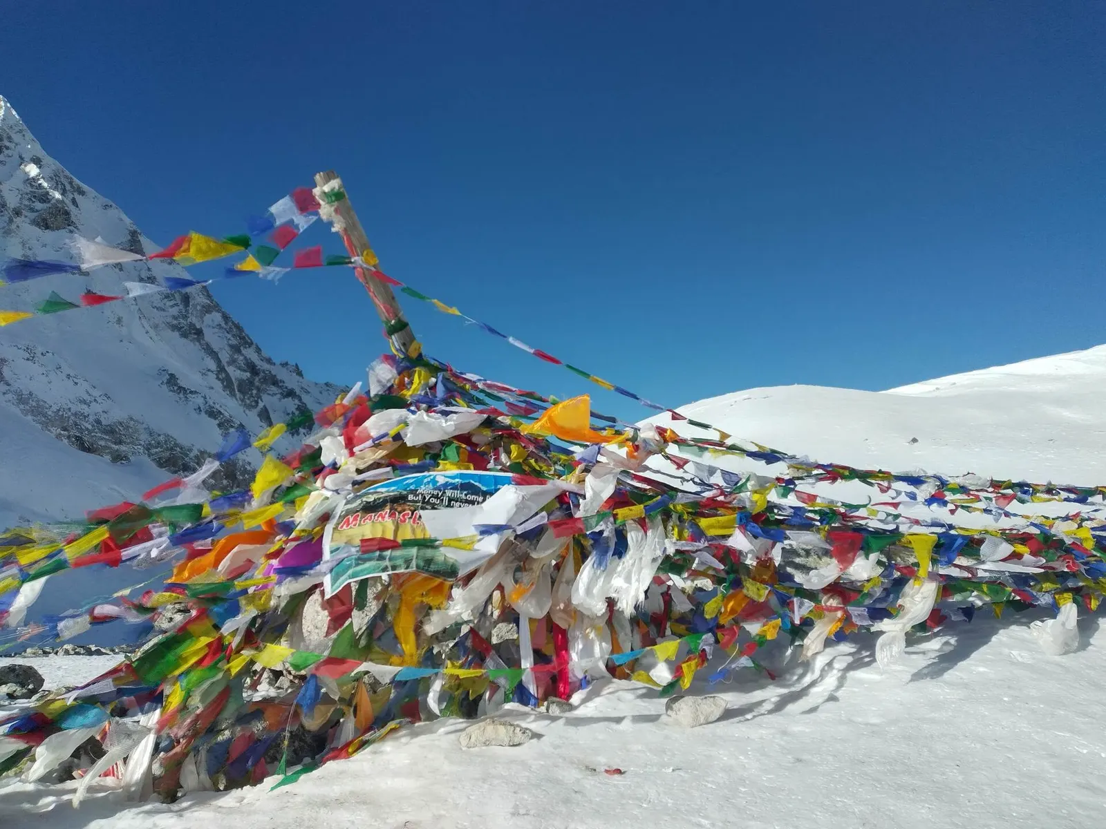
Mountain pass · 5,106 m
The high pass of the Manaslu Circuit, a long glacial crossing from the Budhi Gandaki to the Marsyangdi side.
Trek stop · 900 m
A riverside village of lodges at the mouth of a side stream, the first night's stop for most Manaslu Circuit trekkers.
Trek stop · 2,630 m
The first village of Nubri on the Manaslu Circuit, among barley fields and forest.
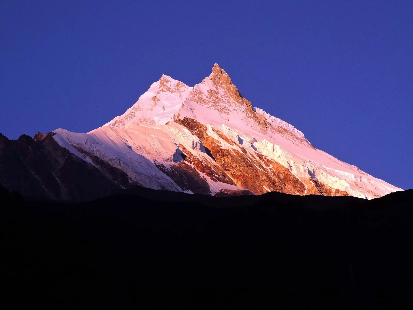
Valley or region
A restricted trekking region around the world's eighth-highest mountain, from the Budhi Gandaki gorge to Tibetan-Buddhist villages and the Larkya La.
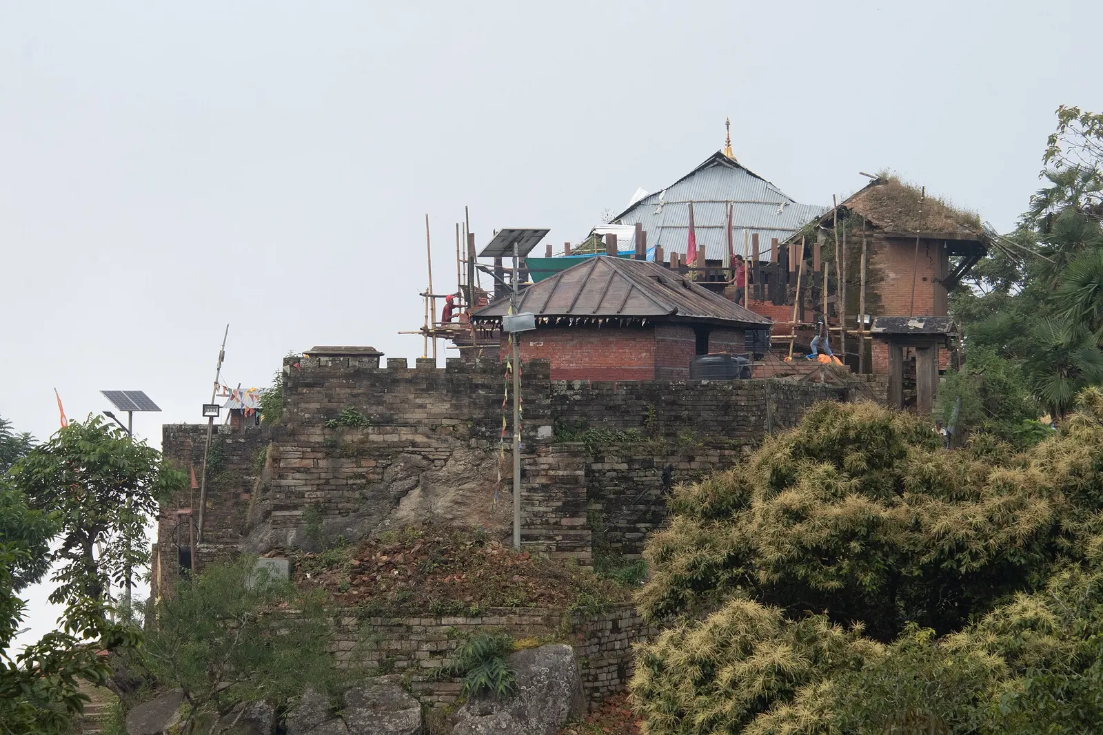
Temple, monastery or heritage site · 1,135 m
The hill town where the Shah kings ruled the Gorkha Kingdom and Prithvi Narayan Shah began the unification of Nepal.