Skip to content

Dhulikhelबलथली

Balthali

A farming village on a ridge above Panauti and Khopasi, reached on foot or by rough road, with terraced fields and homestays.

Plan a trip here
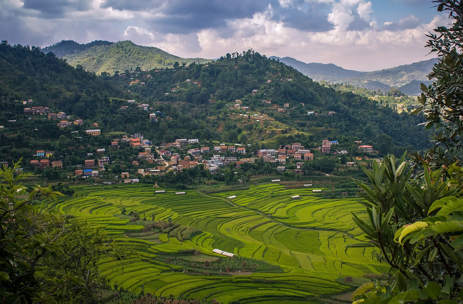
Houses and terraced fields of Balthali village on a hillside.
Photo: Sunil kawan (CC BY-SA 4.0)
Altitude
1,730 m*
Best months
Mar-Apr, Oct-Nov
Type
Town or village
District
Kavrepalanchok, Bagmati
Permit
None needed

Why go

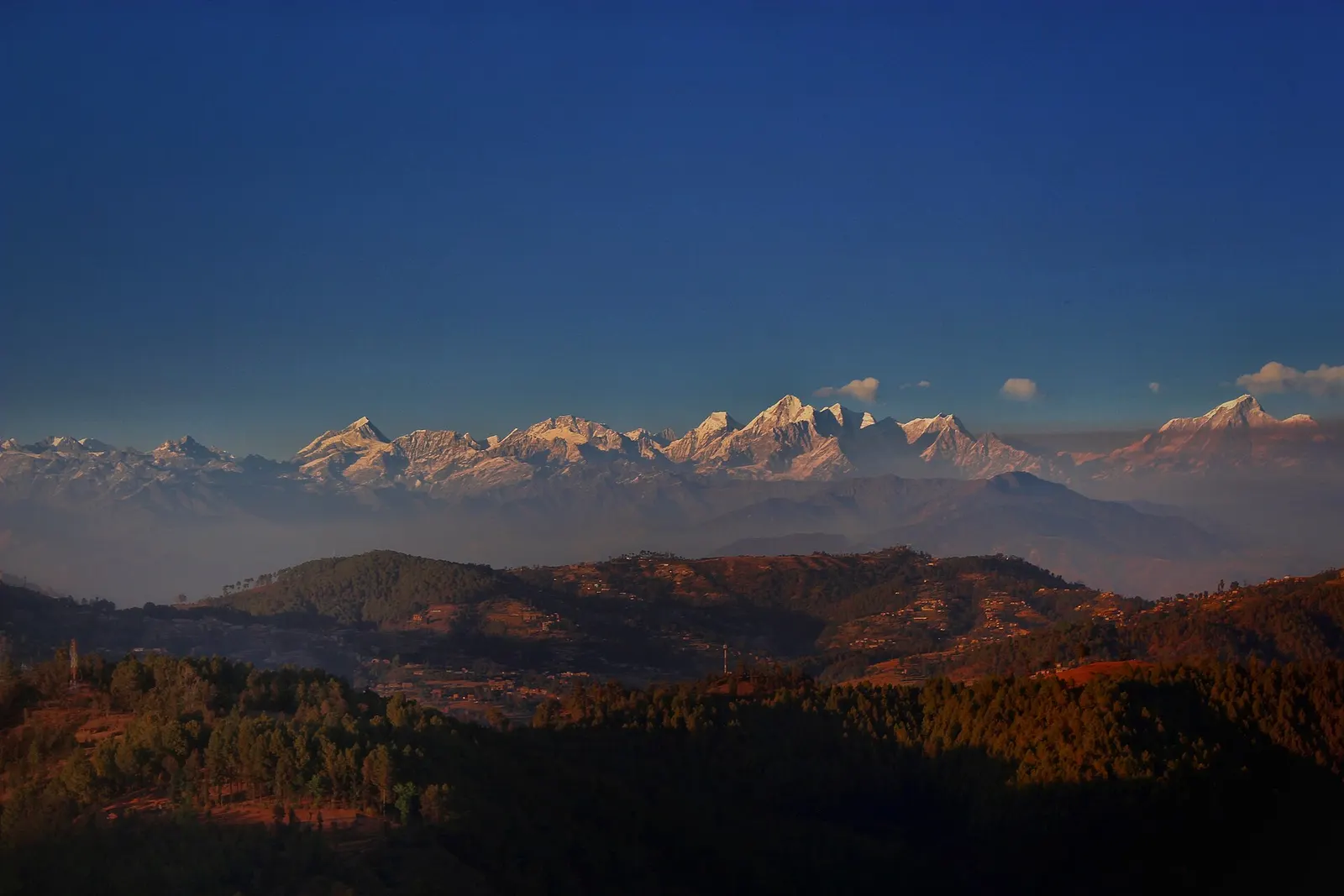
Balthali is a small rural settlement in Kavrepalanchok District, part of the Dhulikhel and Panauti walking area about 40 km south-east of Kathmandu. It spreads along a ridge at roughly 1,700 m above the Roshi river valley, with terraced rice and millet fields falling away on every side and, on clear days, a view north to the snow peaks between Langtang and Gaurishankar.

People come for a slow overnight in the countryside rather than for sights. Mornings are for watching the light over the terraces, afternoons for short walks between hamlets, and evenings for home-cooked dal bhat. It fits neatly into a two or three day loop with Namo Buddha and Panauti, or as a short add-on to a stay in Dhulikhel.

The usual approach is by road to Panauti or Khopasi, then a walk of about 1.5-2.5 hours uphill past fields and small streams. Jeep tracks also reach the area, but conditions vary with the season.

History and culture

The village is home mainly to Tamang and Brahmin-Chhetri farming families, with Newar towns such as Panauti and Khopasi in the valley below supplying markets and temples. Life follows the agricultural calendar: rice planting in early monsoon, harvest in autumn, and Dashain and Tihar celebrated in October and November.

Local stone water spouts with naga (serpent) carvings and small shrines show the mix of Hindu and Buddhist practice common across Kavre. Community and family homestays have grown since the 2000s as a way to earn from visitors without large hotels. Staying with a family is the best way to see daily routines such as milking, fodder cutting and cooking on wood stoves.

Things to do in Balthali

  • Village walk

    Stroll the ridge paths between hamlets, past fields, water spouts and small temples; a gentle 1-3 hours.

  • Panauti to Balthali hike

    Walk up from Panauti or Khopasi in about 1.5-2.5 hours, then continue to Namo Buddha the next day.

  • Sunrise viewpoint

    Climb to the highest part of the ridge early for views of the Himalaya before cloud builds.

Weather and the best time to visit Balthali

Weather in Balthali

Forecast for 1,730 m. Conditions change fast in the mountains.

Weather data: MET Norway, licensed CC BY 4.0. A forecast, not a guarantee.

Best time to visit

Mar-Apr, Oct-Nov

  1. Jan
  2. Feb
  3. Good month: Mar
  4. Good month: Apr
  5. May
  6. Jun
  7. Jul
  8. Aug
  9. Sep
  10. Good month: Oct
  11. Good month: Nov
  12. Dec
Autumn (Sep-Nov)
October and November bring harvest colours, clear air and the best mountain views.
Winter (Dec-Feb)
Dry and clear but cold at night in simple village houses; bring warm layers.
Spring (Mar-May)
Pleasant walking weather with green hills; mountains often hidden by haze in April and May.
Monsoon (Jun-Aug)
Lush rice terraces but frequent rain, slippery trails, leeches and rough road access.

Where to stay

HomestaysResortsGuesthouses

Family homestays are the usual option; there are also a few small resorts with mountain-facing rooms.

No partner stays are listed here yet. List a property.

Getting there

Drive from Kathmandu to Panauti or Khopasi (about 1.5-2.5 hours), then walk up or take a jeep on the rural road.

Nearest hub: Dhulikhel

  • roadKathmandu to Panauti or Khopasi by bus or car via Banepa, about 35-45 km and 1.5-2.5 hours.
  • walkPanauti or Khopasi to Balthali on foot, about 1.5-2.5 hours uphill through farmland.
  • walkNamo Buddha to Balthali on village trails, roughly 3-4 hours.
  • jeepRough rural roads reach the village; check conditions locally, especially in monsoon.

Getting to Balthali, by mode

Nearest hub: Dhulikhel. Times are typical ranges, not schedules, and vary with roadworks, weather and the season.

  • By busfrom Panautiabout 1.5-2.5 hLocal buses

    Buses reach Panauti or Khopasi via Banepa; from there the village is reached on foot or by local jeep.

    When to set off: leave Kathmandu by 08:00 to allow the walk up in daylight

    Dhulikhel, Wikivoyage

  • By car or jeepfrom Panautiabout 0.5-1 h

    Rough rural roads reach the village from the Panauti and Khopasi side; from Kathmandu the whole trip is about 35 to 45 km and 2 to 3.5 hours.

    Road: Rough earth and stone rural road; a jeep or other 4WD is normally needed, and in the monsoon it can be walkable only.

    Balthali village photo with location, Wikimedia Commons

  • By motorbikefrom Panautiabout 0.5-1 hModerate riding

    Steep, loose rural track above the Roshi valley, hard going when wet.

    Road: Rough earth and stone track, slippery and rutted in the monsoon.

    Nepal, Wikivoyage

  • On footfrom Panautiabout 1.5-2.5 h1.5-2.5 h from Panauti or Khopasi, uphill through terraced farmland

    A steady climb through farmland from the valley floor to the ridge village.

    Dhulikhel, Wikivoyage

Where people go next

  • Panaution foot, about 1.5-2.5 hDownhill to the confluence town.
  • Namo Buddhaon foot, about 3-4 hNorth along village trails to the stupa.
  • Dhulikhelby car or jeep, about 1-1.75 hBack up to the Araniko Highway town.
Mount Everest 8,848.86Kangchenjunga 8,586Dhaulagiri I 8,167Manaslu 8,163Annapurna I 8,091BalthaliKathmandu
Boundary: Government of Nepal, Survey Department (2020). Peak data: Wikidata.

Permits and fees

None needed

No permit is needed to visit Balthali.

Verify before travel: permit rules and fees change. Checked 2026-10-06 against Dhulikhel and area (Wikivoyage).

Risks and conditions

Seasonal risks around Balthali

What this place is typically exposed to, and when. These are seasonal patterns, not a report on conditions now.

  • Landslidesmoderate in a typical yearJun-Sep

    The rural roads up from Panauti and Khopasi are earth and stone and slip or wash out in the June to September rains, so the last stretch is sometimes only walkable.

    Nepal, Wikivoyage

  • Road blockagesmoderate in a typical yearJun-Sep

    Monsoon rain typically leaves the Balthali access roads rutted and impassable to cars, and the Araniko feeder road is slow.

    Araniko Highway, Wikipedia

  • Othermoderate in a typical yearJun-Sep

    Trails through the terraces are slippery and leech-ridden from June to September, and the ridge views are usually lost in cloud.

    Dhulikhel, Wikivoyage

  • Coldlow in a typical yearDec-Feb

    At about 1,730 m December to February nights are cold in simple village houses with no heating.

    Balthali village photo with location, Wikimedia Commons

Check current conditions before you travel

Roads, trails, passes and flights change with the weather and with roadworks, and nothing on this page describes conditions today. Before you set off, check the Department of Hydrology and Meteorology for weather and flood warnings, the Nepal Disaster Risk Reduction Portal for incidents, and the local authority, police or your licensed operator for road, trail and flight status.

Practical tips

  • Carry enough cash; there is no ATM in the village (the nearest are in Panauti and Banepa).
  • Mobile signal is generally available on the ridge but can drop in valleys.
  • Ask before photographing people and homes, and remove shoes when entering a house.
  • Trails are steep and slippery after rain; wear proper walking shoes.

Treks through Balthali

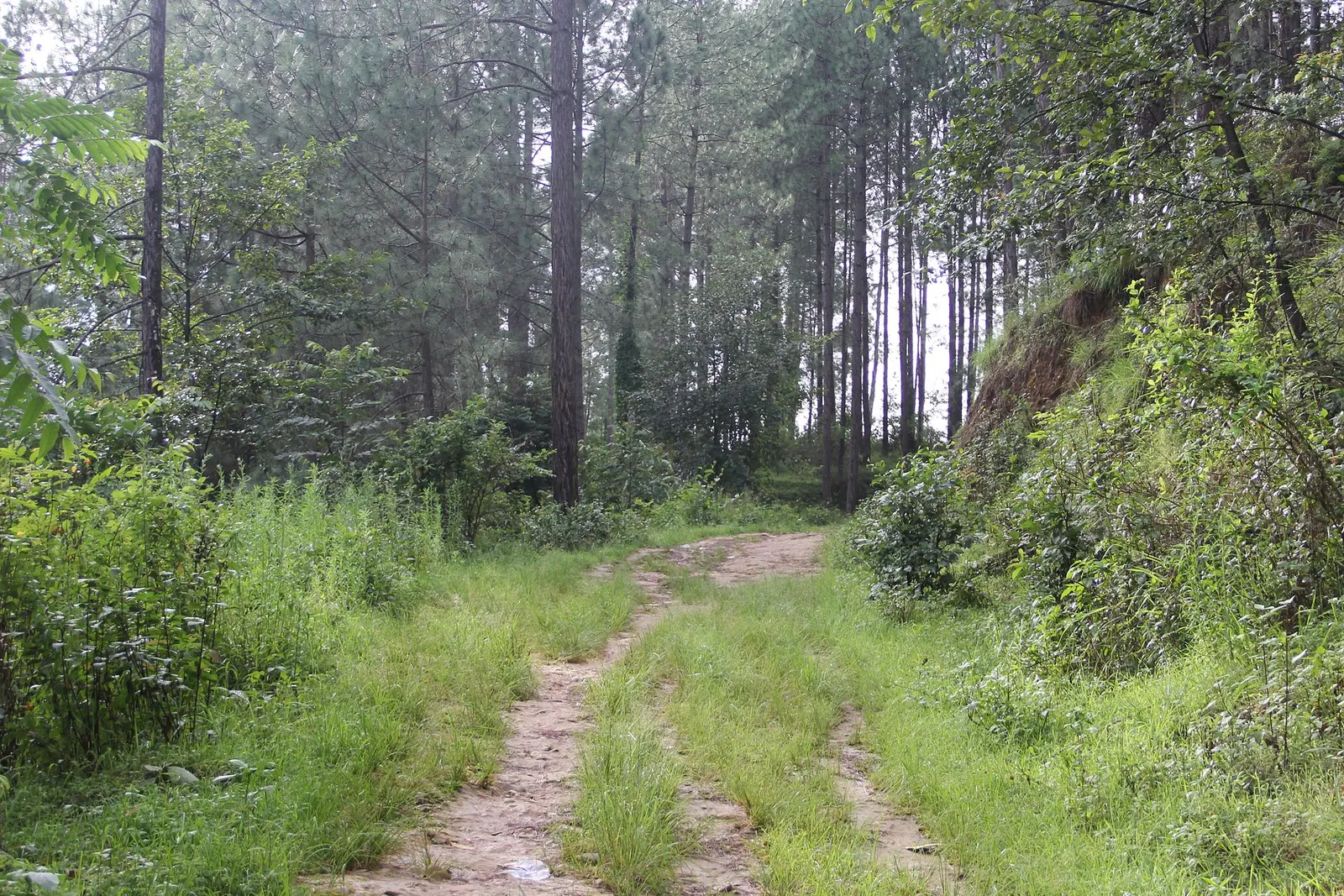
A grassy dirt track leads through tall pine forest on the way to Balthali village.

A short, low walk south-east of Kathmandu from Dhulikhel to the Buddhist pilgrimage site of Namo Buddha, on to the farming village of Balthali, and down to the old Newar town of Panauti. No permit needed.

Days
3 days
Maximum altitude
1,750 m
Difficulty
Easy

Questions about Balthali

How do I get to Balthali from Kathmandu?

Travel to Panauti or Khopasi by road in about 1.5-2.5 hours, then walk up for 1.5-2.5 hours or take a jeep on the rural road.

What is there to do in Balthali?

Village walks, sunrise views of the Himalaya on clear mornings and homestay stays; it combines well with Namo Buddha and Panauti.

When is the best time to visit Balthali?

October-November and March-April have the most pleasant weather; autumn has the clearest mountain views.

More in Dhulikhel

All of Dhulikhel
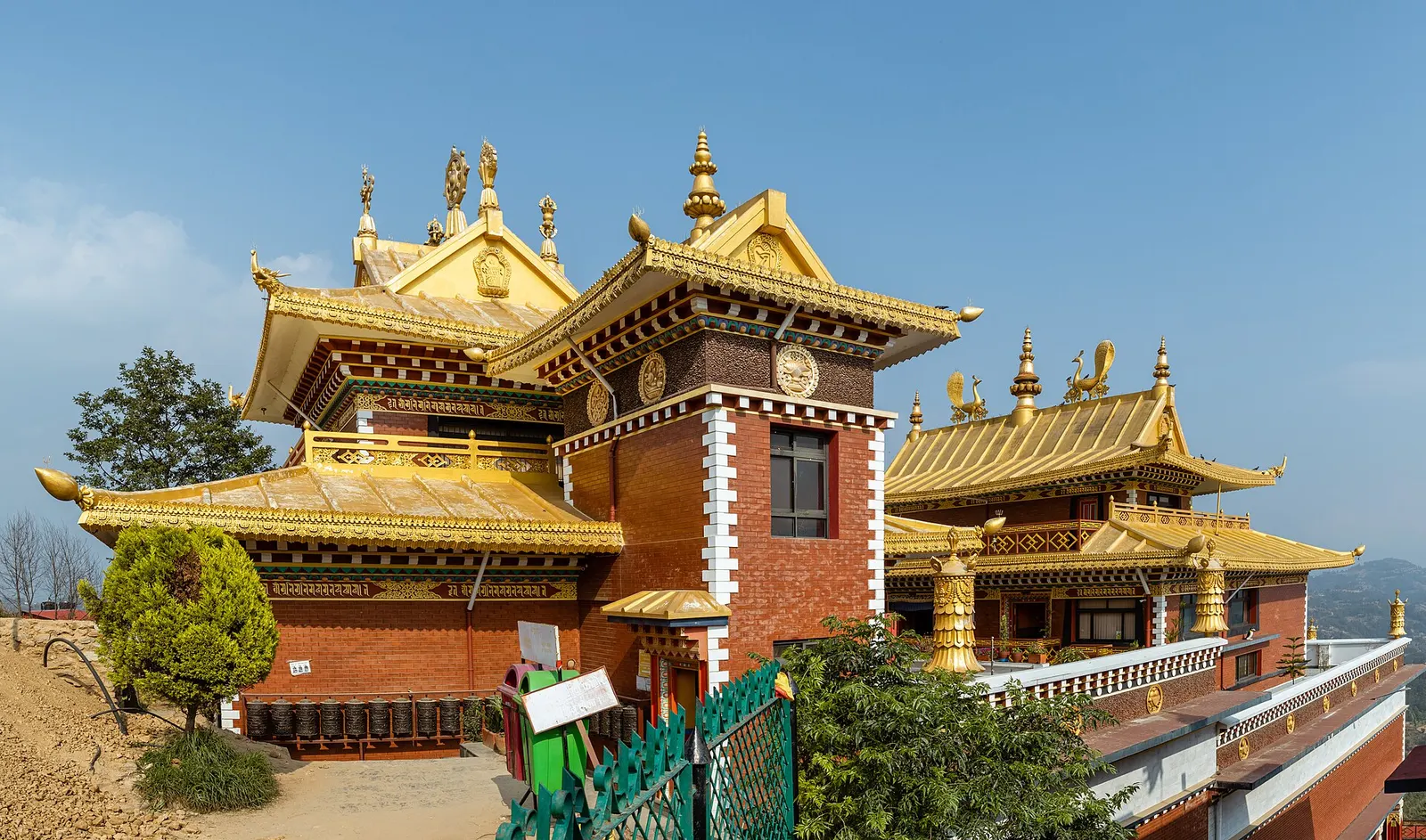
Panorama of the Thrangu Tashi Yangtse Monastery buildings on the Namo Buddha hilltop.

Temple, monastery or heritage site · 1,750 m

Namo Buddha

A hilltop stupa and Tibetan Buddhist monastery south-east of Dhulikhel, tied to the story of a prince who gave his body to a starving tigress.

Nearby

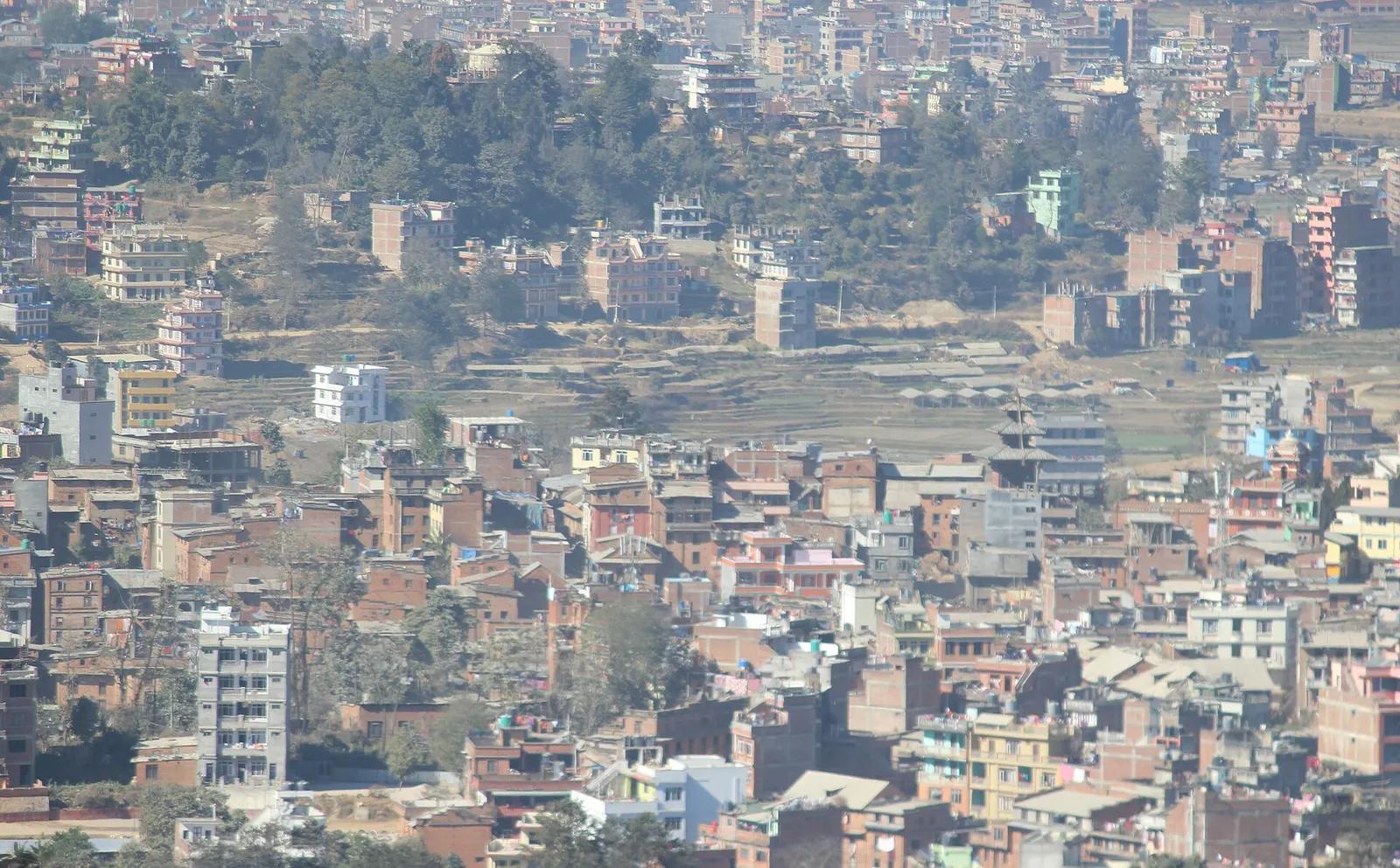
Houses of Dhulikhel spread across a ridge, seen from the hilltop Kali temple, with a temple roof in view.

Town or village · 1,550 m

Dhulikhel

A Newar hill town on the eastern rim of the Kathmandu Valley, with a wide Himalayan skyline and walking trails to Namo Buddha and Panauti.

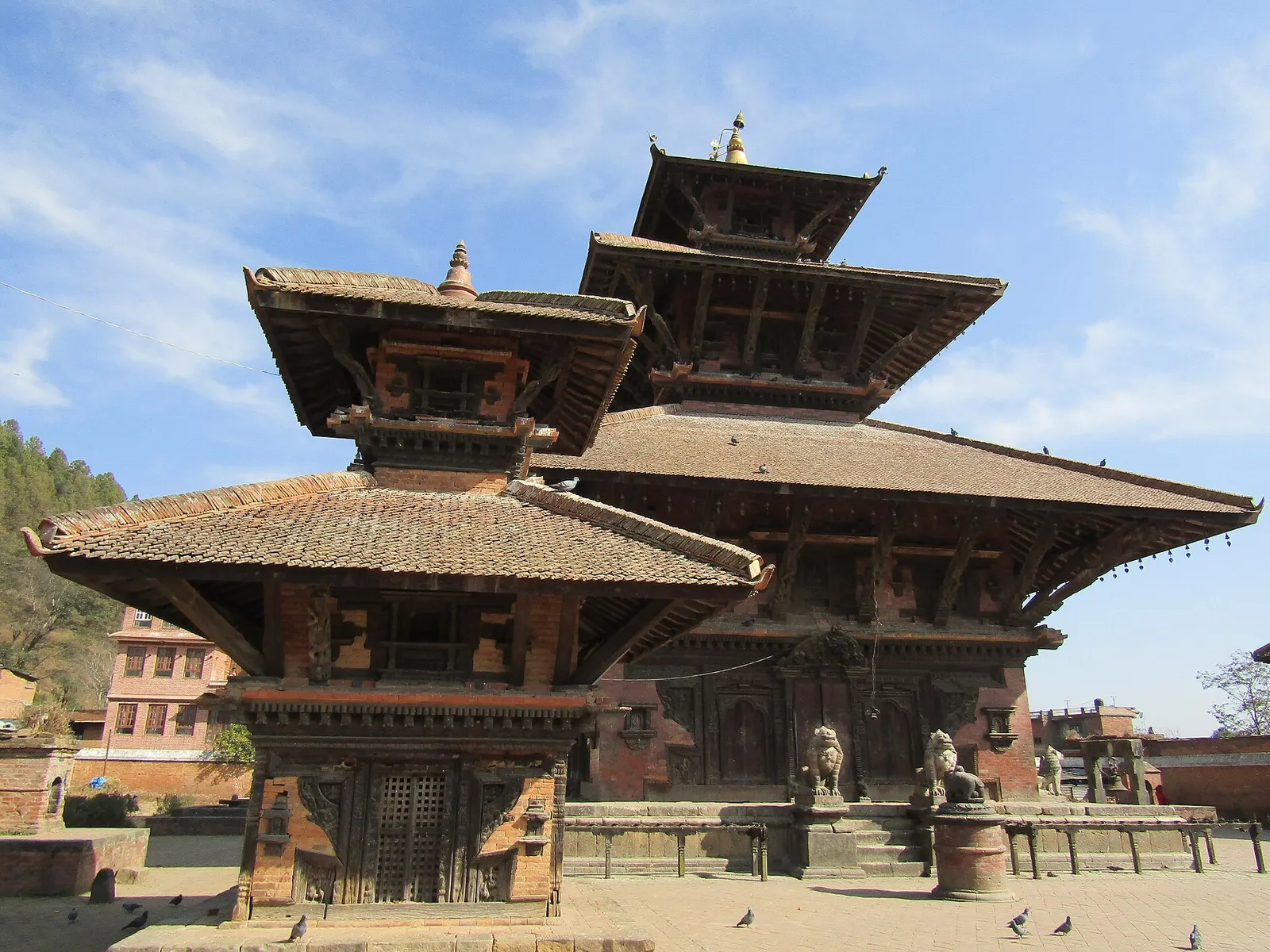
The tiered Indreshwar Mahadev temple in Panauti, Kavrepalanchok.

Town or village · 1,442 m

Panauti

A small medieval Newar town at a river confluence south-east of the Kathmandu Valley, with old temples, quiet lanes and community homestays.

Editorial draft: facts are being checked against the sources below. Last checked 2026-10-06. Sources: Balthali village photo with location (Wikimedia Commons), Dhulikhel (Wikivoyage)