

Town or village · 1,401 m
Bhaktapur
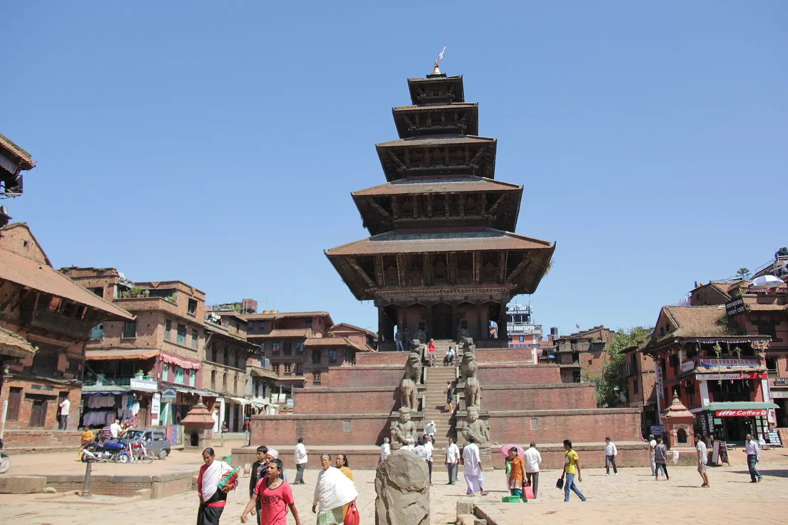
A medieval Newar city in the east of the Kathmandu Valley, known for its temple squares, pottery, woodcarving and festivals.
Bhaktapurनगरकोट
A ridge on the valley rim with a long view of the Himalaya at sunrise.
This is Nagarkot on the eastern rim of the Kathmandu Valley in Nepal; it is not Nagarkot (Kangra) in Himachal Pradesh, India.
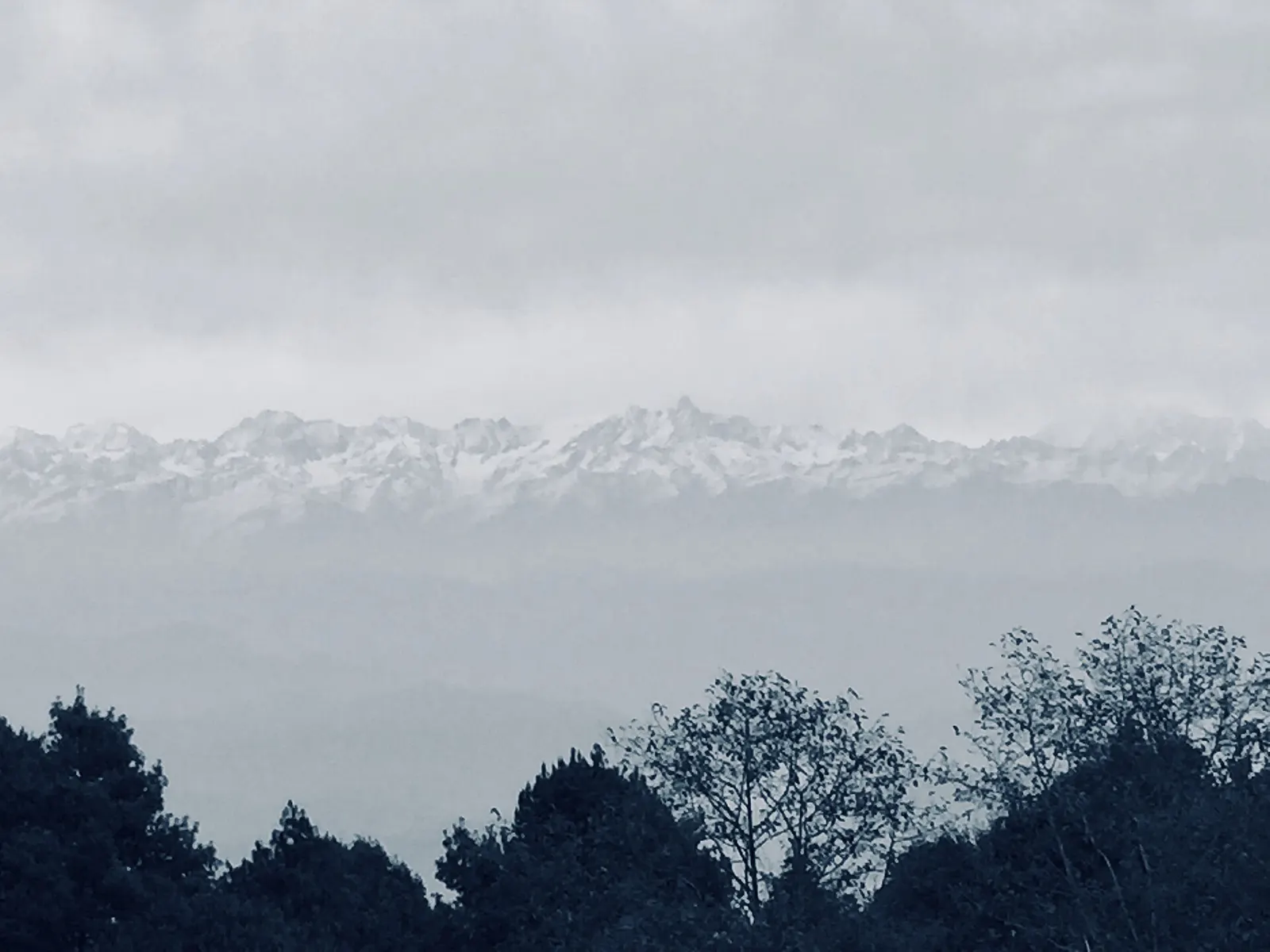
Nagarkot sits on a ridge at about 2,175 m on the north-eastern rim of the Kathmandu Valley, about 13-15 km by road above Bhaktapur and some 30 km from central Kathmandu. It is the valley's best-known viewpoint: on a clear morning the panorama stretches across much of the central and eastern Himalaya, from the Annapurna and Manaslu ranges in the west through Ganesh Himal, Langtang and Jugal to Gaurishankar and Rolwaling in the east, with the top of Everest just visible far to the east on exceptionally clear days.
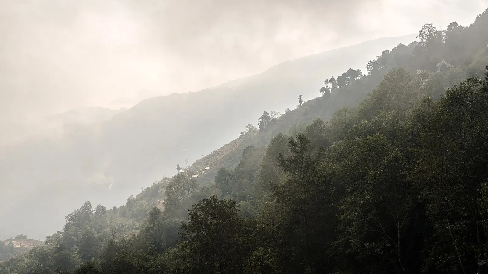
Most visitors come for sunset and sunrise, staying a night in one of the many hotels and lodges strung along the ridge. The best views are from the high points: the view tower on the ridge about 4 km south of the village, and terraces of the hotels themselves. Below, the slopes fall away in terraced farmland and pine forest to the valley on one side and the Indrawati basin on the other.
Nagarkot is also a good base for walking. Well-used trails lead down to the temple of Changu Narayan and on to Bhaktapur, along the ridge to Dhulikhel, and north to Chisapani and Sundarijal. As part of Bhaktapur district, it is often combined with a night in Bhaktapur, the medieval city below.
The story
For many people in the valley, watching first light reach the peaks from Nagarkot is darshan, a blessed sight of the mountains that are the home of the gods. The dawn view is treated by some as a form of morning prayer.
The name means 'town fort', and Nagarkot began as a hilltop fort used to watch over the eastern approaches to the valley. It later became a summer retreat for the royal family before developing, from the 1970s and 1980s, into a hill station for international and domestic visitors. Wikipedia counts eight of Nepal's Himalayan ranges visible from the ridge.
The ridge villages are home mainly to Tamang, Brahmin and Chhetri farming families, and Tamang culture is visible in the small gompas and prayer flags around Nagarkot. The 2015 earthquake damaged homes in the surrounding villages, and many have since been rebuilt.
Sunrise at the view towerFree
Walk or drive to the view tower before dawn. Clearest skies are usually October to March.
Nagarkot to Changunarayan walkFree
A 4 to 5 hour, mostly downhill walk along the ridge to Changunarayan temple. It can be walked independently; a guide is optional.
indicative, about US$20 if you hire a guide
Watch sunrise
Be on a hotel terrace or at the view tower before dawn; autumn and winter give the clearest views.
Hike to Changu Narayan
Walk down through villages and forest to the ancient temple in about 3-4 hours, then continue to Bhaktapur by bus or on foot.
Walk to Dhulikhel
Follow the ridge and valley trails south-east to Dhulikhel in about 5-6 hours.
Start from Sundarijal
Arrive on foot via Chisapani on the Kathmandu Valley rim trek, a two-day walk from Sundarijal.
Forecast for 2,175 m. Conditions change fast in the mountains.
Weather data: MET Norway, licensed CC BY 4.0. A forecast, not a guarantee.
Oct-Feb
Hotels along the ridge, most with east- or north-facing rooms. Ask for a mountain-view room.
Many hotels, resorts and simpler lodges along the ridge, most facing the mountains.
No partner stays are listed here yet. List a property.
Breakfast with the view is the main event. Some small farms on the ridge grow vegetables for local kitchens.
Nagarkot is reached by road via Bhaktapur, about 30 km from central Kathmandu.
Nearest hub: Kathmandu
Nearest hub: Kathmandu. Times are typical ranges, not schedules, and vary with roadworks, weather and the season.
By busfrom Bhaktapurabout 0.75-1.25 hTourist and local buses
Local buses climb from Bhaktapur to Nagarkot in about an hour, and tourist minibuses run direct from Kathmandu.
When to set off: come up in the afternoon to be in place for the next day's sunrise
By car or jeepfrom Kathmanduabout 1.5-2 h
About 30 to 35 km via Bhaktapur, with the last 13 to 15 km climbing the rim; most visitors arrive the evening before sunrise.
Road: Sealed but narrow, steep and tightly winding above Bhaktapur, with monsoon-damaged patches.
By motorbikefrom Bhaktapurabout 0.6-1 hModerate riding
A favourite short climb out of the valley; the hairpins are tight and the surface broken in places.
Road: Sealed, steep and winding with broken patches; slippery in the monsoon.
On footfrom Chisapaniabout two days from Sundarijal via Chisapani along the valley rim
Nagarkot is the eastern end of the Kathmandu valley rim walk from Sundarijal via Chisapani, normally about two days.
When to set off: start each rim stage early; there is little shade and few shops on the ridge
None needed
No permit is needed for Nagarkot. Treks arriving via Chisapani pass through Shivapuri Nagarjun National Park, which charges an entry fee.
Verify before travel: permit rules and fees change. Checked 2026-10-06 against Nagarkot, Wikivoyage.
What this place is typically exposed to, and when. These are seasonal patterns, not a report on conditions now.
Landslidesmoderate in a typical yearJun-Sep
The rim road up from Bhaktapur is cut into steep hillside and monsoon rain typically triggers slips and edge collapses between June and September.
Road blockagesmoderate in a typical yearJun-Sep
Slips and washouts on the hill road typically delay the climb in the monsoon, and the Araniko Highway approach is slow in heavy rain.
Coldmoderate in a typical yearDec-Feb
At about 2,175 m the ridge drops to around freezing on December to February nights, with frost at dawn; ask for a heated room in winter.
Othermoderate in a typical yearJun-Sep
From June to August cloud usually hides the mountains for days at a time and the forest trails down the rim are slippery and leech-ridden.
Snowlow in a typical yearDec-Feb
Light snow falls on the ridge in some winters, which can make the viewpoint paths and the last of the road slippery.
Check current conditions before you travel
Roads, trails, passes and flights change with the weather and with roadworks, and nothing on this page describes conditions today. Before you set off, check the Department of Hydrology and Meteorology for weather and flood warnings, the Nepal Disaster Risk Reduction Portal for incidents, and the local authority, police or your licensed operator for road, trail and flight status.
Safety
Mornings are cold from November to February. Mountain views are often hidden by haze in late spring and cloud in the monsoon.By taxi, about 1.5-2 hours, or by bus via Bhaktapur, changing there for the Nagarkot bus.
The top of Everest is just visible far to the east on exceptionally clear days, but it is small and often hidden.
October to February, when the air is clearest; mornings give the best mountain views.
About 2,175 m, with sources ranging from 2,163 m to 2,195 m. It is too low for altitude sickness to be a usual concern.
Yes. One night gives you sunset and sunrise. Add a morning for the walk to Changunarayan.
Town or village · 1,401 m
A medieval Newar city in the east of the Kathmandu Valley, known for its temple squares, pottery, woodcarving and festivals.
Town or village · 1,400 m
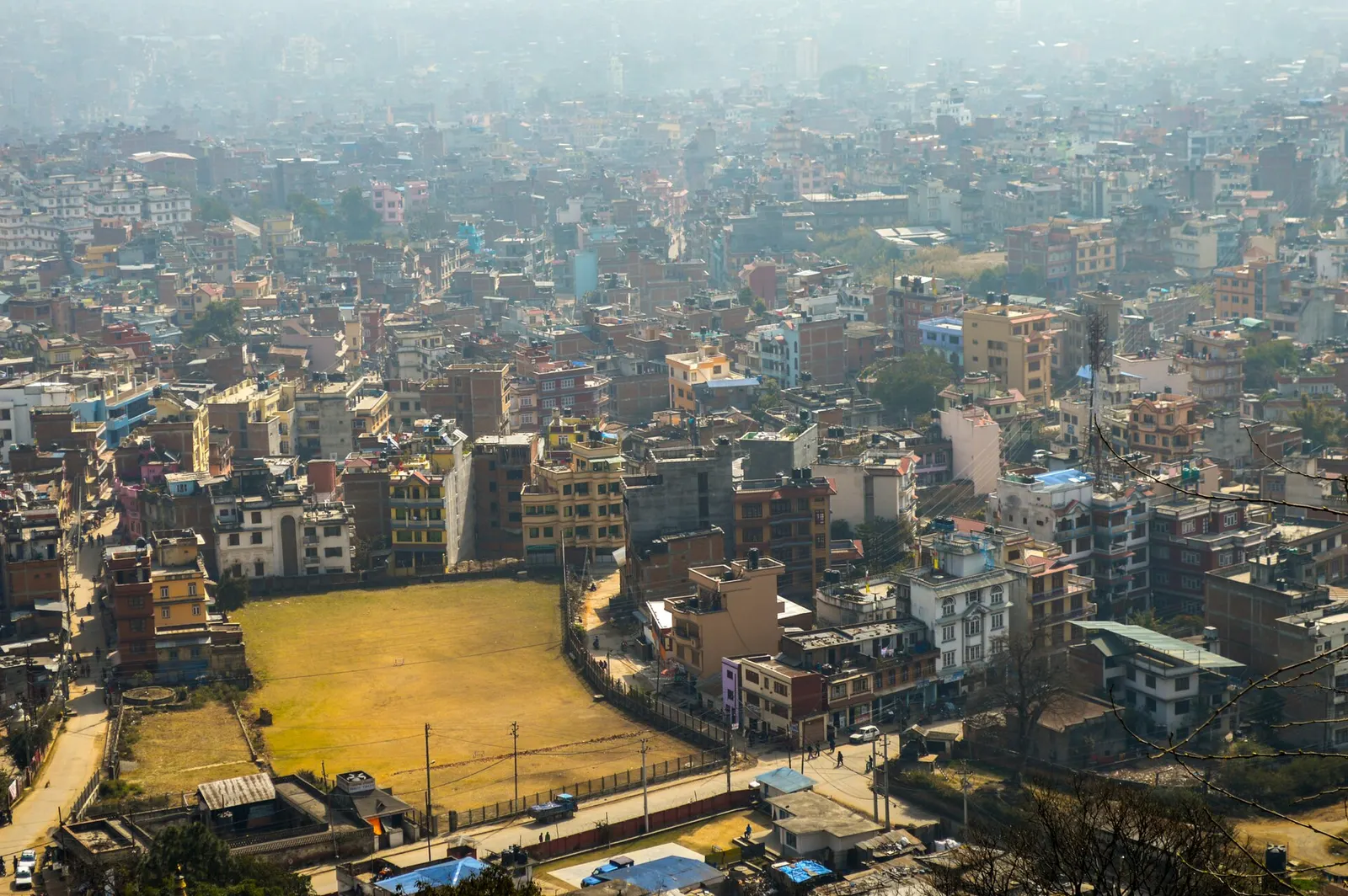
Nepal's capital, a sprawling valley city wrapped around a medieval Newar core, with major Hindu and Buddhist sites and the country's main airport.