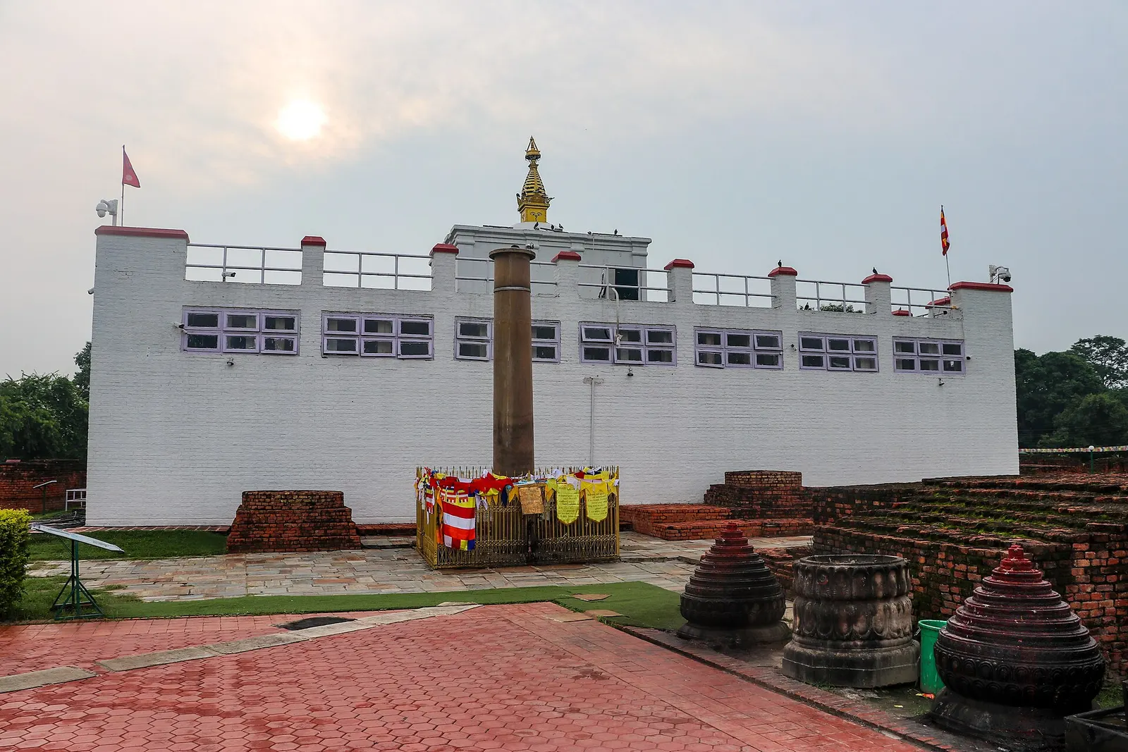
Temple, monastery or heritage site · 150 m
Lumbini
The birthplace of the Buddha in the Terai, a sacred garden with an Ashokan pillar, ringed by monasteries from across the Buddhist world.
Chitwan & Teraiतिलौराकोट
Ruins of an ancient walled city identified with Kapilavastu, where tradition says Siddhartha grew up.
Higher seasonal exposure: heat (Apr-Jun).
Tilaurakot is an archaeological site in Kapilvastu district, west of Lumbini, where the remains of an ancient fortified city lie among trees beside the Banganga river. Many scholars and the Nepali authorities identify it with Kapilavastu, the capital of the Shakya clan, where Prince Siddhartha is said to have spent his early life before leaving to seek enlightenment.
Visitors can walk among excavated brick foundations, the outline of the city walls and a surrounding moat, and the remains of gateways. The eastern gate is traditionally identified as the one through which Siddhartha left the palace. Large old trees shade the site, and the atmosphere is calm and reflective, especially in the early morning.
A small museum near the site displays pottery, coins, toys and other finds from the area. Tilaurakot is usually visited as a day trip from Lumbini, often combined with the Ashoka pillars at Niglihawa and Gotihawa and other sites around Taulihawa.
The identification of Tilaurakot with Kapilavastu rests on its location, its early date and descriptions by Chinese pilgrims such as Faxian and Xuanzang, who visited the region centuries after the Buddha. A rival site at Piprahwa in India has also been proposed, and the question remains debated.
Excavations since the twentieth century, including recent work by Nepali and international archaeologists, have revealed the plan of the city, its walls and streets. The site is on Nepal's tentative list for World Heritage status as part of the wider Lumbini area. Local Hindus also worship at a small shrine within the site, and the area is surrounded by Tharu and Madhesi villages.
Walk the ruins
Explore the excavated foundations, walls and gateways, ideally in the cool of early morning.
Visit the museum
See finds from Tilaurakot and nearby sites in the small museum near the entrance.
Circuit of Ashoka pillars
Continue to Niglihawa and Gotihawa to see pillars erected by the emperor Ashoka.
Conditions change fast in the mountains.
Weather data: MET Norway, licensed CC BY 4.0. A forecast, not a guarantee.
Oct-Mar
Most visitors stay in Lumbini or Bhairahawa; simple hotels are available in Taulihawa.
No partner stays are listed here yet. List a property.
Drive west from Lumbini or Bhairahawa to Taulihawa, then a short distance north to Tilaurakot.
Nearest hub: Lumbini
None needed
No permit is required. A site or museum ticket may be charged; check on arrival.
Verify before travel: permit rules and fees change. Checked 2026-10-08 against Tilaurakot, Wikipedia.
What this place is typically exposed to, and when. These are seasonal patterns, not a report on conditions now.
Heathigh in a typical yearApr-Jun
April to June is very hot on the open plain, and there is limited shade between sites.
Floodingmoderate in a typical yearJul-Sep
Monsoon rain can flood fields and minor roads around Tilaurakot.
Coldlow in a typical yearDec-Jan
Thick fog often covers the plains on winter mornings, slowing road travel.
Check current conditions before you travel
Roads, trails, passes and flights change with the weather and with roadworks, and nothing on this page describes conditions today. Before you set off, check the Department of Hydrology and Meteorology for weather and flood warnings, the Nepal Disaster Risk Reduction Portal for incidents, and the local authority, police or your licensed operator for road, trail and flight status.
An archaeological site in Kapilvastu district identified by many with Kapilavastu, the Shakya capital where Siddhartha is said to have grown up.
It is roughly an hour's drive west of Lumbini.
No. It is on Nepal's tentative list for World Heritage status but is not part of the inscribed Lumbini property.
Yes, a small museum near the site displays local finds.
Temple, monastery or heritage site · 150 m
The birthplace of the Buddha in the Terai, a sacred garden with an Ashokan pillar, ringed by monasteries from across the Buddhist world.
Temple, monastery or heritage site
A broken Ashoka pillar beside an old pond, linked by its inscription with the Buddha Konagamana.
Temple, monastery or heritage site
The stump of an Ashoka pillar and a brick stupa, linked by tradition with the Buddha Krakuchanda.